
Cityscape of laissez-fair 1860-1890
The development of Residential parks, civic quarters and working-class neighborhoods
How the village character took shape into the new suburbs uw header hier toe
The city image of the beautiful city was not always a frivolous city image. The residential parks were given beautiful villas in leafy greenery. The bourgeois districts were uniform rowhouses in eclecticism architecture whit a lot of plaster on brick. In the working-classdistricts, the masonry was dull and the meagre frivolity of the bourgeois neighborhoods disappeared. Because of the way of layout of neighborhoods and construction of houses, the three ensembles each got their own character and location within the municipality. Asargued in the chapter above, the village character was not a conscious choice for a city image, rather it was the result of geomorphology and geopolitical context.
A vivid picture of the old city and the new neighborhoods was sketched in literature by the journalist Johan Gram (1893, 1906), the writer Louis Couperus, the resident Nini Brunt (1977) about the old city and at the time new Zeeheldenkwartier, the city walker Ton Ven (1962)which is a pseudonym for the writer Bordewijk whose stories often take place in The Hague. Supplemented with the first photography, this gives an impression of the atmosphere and character of the sometimes completely different districts of The Hague.
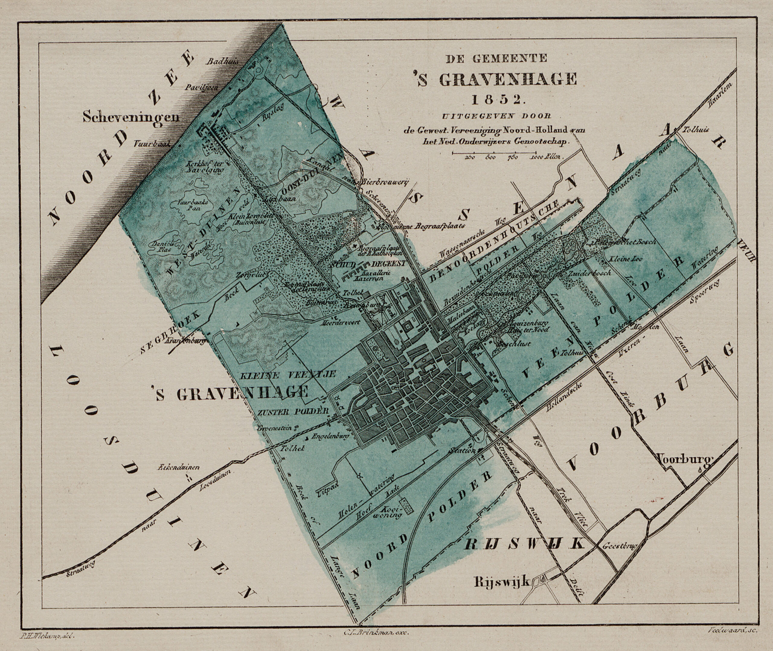
After the French Era, the Hofkwartier and the village of The Hague were legally united and gained one municipal administration. In the year 1861 a breakthrough of great significance took place. The medieval village ‘die Haghe’ with its center the Dagelijkse Groenmarkt (daily green market) was connected to the Buitenhof by the construction of the Gravenstraat. The symbolic wall between the court and the bourgeoisie was torn down after 600 years.
However, between 1841 and 1892 new walls had been erected with the Stedelijk Keur (urban hallmark) between the wealthy bourgeoisie who lived on the sand in leafy residential parks, the ordinary bourgeoisie on the distinguished streets with double rows of trees and green squares, and the proletariat who kept themselves alive in the bare slums in thepeat. In a relatively short time, the city was spatially divided into three types of urban ensembles where socio-economically like-minded people came to live together: workers’ quarters, civilian quarters and residential parks.
Different socio-economic networks of people coincided with the different qualities of the urban ensembles and facilities. This affected the residential patterns in the city where mostpeople had no free choice (Gram, 1893, 1906) (Eberstadt, 1914) (Van Gelder, 1937) (Bakker Schut, 1939) (Gemeente ’s-Gravenhage, 1948) (Dirkzwager, 1979) (Stokvis, 1987) (Koopmans 1994, 2005) (Schmal, 1995) (Furnée, 2012).
The exodus from the old residential city begins after 1870 and the sorting of the population into residential areas with a different statusand appearance was similar to the developments that were going on in metropolises such as London, Paris and Vienna (Olsen, 1986).Only the building forms were not comparable. While in metropolises and also smaller cities huge urban residential blocks with apartments were built, in The Hague it remained with fine-grained buildings of row houses or at most in two apartments split row house, giving The Hague, together with wide green access roads with double rows of trees, a village character.
The Hague would become more like English than most continental cities in terms of its buildings. In England but also in the Netherlands, Belgium and Bremen, the housing unit is usually the construction unit (although the houses were often constructed in a row of a few houses at the same time) while on the mainland the building unit is often a large residential building or an urban block divided into several housing units (Olsen, 1986: 125). In terms of the socio-economic structure of its population, The Hague was more like London than Paris and Vienna. Because in Paris and Vienna all classes lived together in the large residential buildings, there was a kind of mixture of population. The poorest lived in the attic and the distinguished citizens on the first floor. Because The Hague did not knowthese large residential buildings, the spatial segregation was greater. Houses of the same kind were grouped together in neighborhoods. In addition, the societies with the related networks played an important role and perpetuated the segregated society, just like the clubs inLondon (Olsen, 1986) (Furnée, 2012). Grand cafés such as in Paris and Vienna, where a worker could drink his coffee next to a civil servant, were unthinkable in The Hague. One was aware of the privileged status one possessed. Councilor Stam argued in 1865 in the city council about the appearance:
The Hague ‘is a palatial residence, a city of opulence. I am delighted so often when I hear her praised as one of the fairest citiesin Europe, when I see that wealthy people are constantly attracted by her beauty and settle here to consume their rich incomeamong us. From the influx of such people the city derives chiefly its progress and prosperity. But that progress and prosperity canonly be perpetuated if the city maintains its fame of beauty, which it will only do then, if it is ensured that every enlargement andexpansion is for the least equaled by the beautiful thing we already possess, or, rather, increases its luster even more.’ (Stokvis, 1987: 45).
The Hague also differed from other Dutch cities in this respect, there they made an effort to shape the layout of the new city. Rotterdam had Plan tot Aanleg van Nieuwe Straten in de Polders Cool en Rubroek by W.N. Rose in 1858, Amsterdam had Plan tot Uitbreiding van Amsterdam by J.G. van Niftrik in 1866 and Plan tot Uitbreiding van Amsterdam by J. Kalff in 1875. In The Hague one would never get that far. The city was parceled out and built up by building-land-companies (who turned raw land tot ready to build lots) and construction companies (who bought the lots, construct the houses and sell these) in which wealthy citizens bought or resold shares ‘freely in theirname’, invested and made large profits.
The Hague also differed in terms of the expected residential patterns in cities. For these patterns in the pre-industrial city, Sjoberg (1961) presented a model in which the elite of the city lived in the center and the poor were located more to the outskirts of the city. Itwas there that the distance of the poor from the political and religious center was greatest. For Amsterdam, this model is only partiallyvalid (Lesger, Leeuwen & Vissers, 2013). The poor did indeed live on the outskirts, but the rich citizens did not live in the center around 1830, but in an exclusive zone in the canal belt. Cadastral data on real estate from 1832 were used as the source for this study, whichwere translated into rents. For The Hague, too, the model only partially holds Sjoberg’s conclusion. After all, legally the Hofkwartier, which covered about 25% of the city, was a separate zone until the beginning of the nineteenth century. The Lange Voorhout, the Vijverberg and the Plein formed a green universe of wealthy citizens and administrators far from the noisy center at the DagelijkseGroenmarkt, the Hoogstraat and the Wagenstraat. On the outskirts of the city, you could indeed see the shabby houses as in the Rivierenbuurt, Het Kortenbos and Spuikwartier (Stokvis, 1987).
In The Hague, the canals were only built at the beginning of the seventeenth century, which is fairly late. The advantage was that the surface area within the canals was much larger than in classic Dutch water cities. There was simply more room to grow and the canalswas not a barrier. Until 1870, apart from the spacious country estates, the urban developments also took place mainly within the canalsas densification in inner areas and on the edges or as damage repair from the French Era. When in The Hague after 1870 the layout of neighborhoods outside the canals was finally taken up by private individuals, handy entrepreneurs anticipated the social economical differences in the city. Due to the enormous influx of population, homes were built in stock, whereby an estimate was made of the budget of the buyers or tenants. Building-land-companies, construction companies and architects shaped segregation with painful precision with houses, streets and urban ensembles. In all three ensembles, the village character was emphasized by the low buildingsand small scale. No Paris, Copenhagen or Berlin. Although the qualities between the low-rise buildings of the residential parks andslums differed.
Three urban ensembles
Between 1870 and 1890, the three types of urban ensembles were sharply defined in terms of typo-morphological structure.
In the working-class districts such as the Schilderswijk, meadow after meadow was filled with building blocks, with slums in the courtyards,most of which were demolished after the war. Much better in quality, but sometimes with a similar building structure, some were charity courtyards.
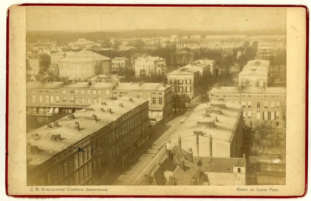
The civilian districts such as the Archipelbuurt and the Zeeheldenkwartier formed unique iconic urban ensembles with spaces consisting of grid street plan with representative wider streets and ronds-points such as Bankaplein, Anna Pauwlonaplein, Prins Hendrikplein and Koningsplein. The other streets were smaller and sometimes courtyards appeared in the courtyards.
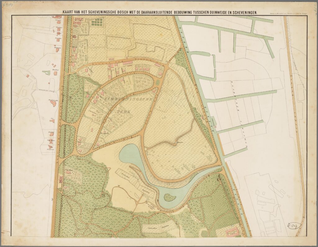
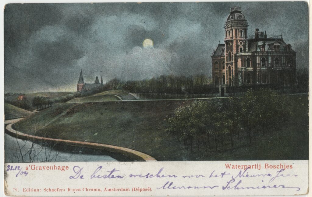
The residential parks were located in a ring around the Scheveningse Bosjes in the vicinity of the seaside resort, such as the Van Stolkpark and theBelgisch Park. In a park-like setting stood the white villas with verandas and balconies, the summer houses of port barons and industrialists.
The social homogeneity within the living environments became an increasingly important consideration when choosing a place to live (Stokvis, 1987) (Schmal, 1995). Driven by status or lack of money, socio-economically like-minded people sought each other out in the qualitatively different neighborhoods. The wealthy in the residential parks, the citizens and in the civic quarters and the paupers in the revolution-building districts. Each district was given its own atmosphere, its own amenities, its own urban spaces and its own typology ofbuildings. The leafy greenery was mainly reserved for the residential parks and the avenues through civilian districts such as Regentesselaan.
The activities of the lawyer and entrepreneur Mr. Th. van Stolk were exemplary for the period 1860-90. On the sand in a park-like landscape, he laid out the Van Stolkpark with its beautiful white villas by, among others, the architect Westra. In the Zeeheldenkwartier, Van Stolk’s street plan was already more sober and simple houses for the lower middle-class were built. In the Rivierenbuurt workers’ quarter, Van Stolk developed workers’ houses and slums of the lowest quality. The trade-off between the investment costs and therevenues was assessed differently by Van Stolk at each location in the city.
A factor in this must have been that the original land price negotiated by the Grand Duchess at the auction near the seaside resort wasprobably different from elsewhere in the city. The motive of all the individuals who worked on the city and organized themselves intoLimited Companies was usually the same: maximizing revenues.
Causes of spatial segregation
There were a number of important factors that led to these three specific urban ensembles.
First of all, the state formation process had entered a phase in which wealthy citizens participated more than before in municipal government thanks to the Constitution (1848), Municipal Act (1851) and the census suffrage that was introduced in 1848 until the amendment of the law in 1887, after which the middle-class was also allowed to vote. The main people involved in the city image of laissez-faire were these wealthy citizens. Just after the introduction of the municipal act, the conservatives still dominated in The Hague, but the liberals gained more and more ground until they gained the majority at the end of the nineteenth century. The era of Mercantilism, the ossified market, protectionism and conservative guilds came to an end and liberalization of the economy and free trade in the colonies increased. Until 1850, the Netherlands was more or less at a standstill, but between 1850 and 1890 the industrial revolution would continue. This liberal state was a prerequisite for industrialization (Lintsen et al., 1992-1994, 2003, 2005).
Secondly, the Crédit Mobilier phenomenon suddenly made a lot of international capital available (Vos, 2003). In Public LimitedCompanies, various (construction) disciplines could be organized and undertake urban development together. The shares of thesecompanies were not traded in registered form. Public limited companies already existed in the seventeenth century, but due to changesin the capital market, a new dynamic took place: many more entrepreneurs took a gamble, conservative and liberal.
Thirdly, there was a significant increase in population and the city received many new affluent residents. There was a densification withinthe canals and courtyards were filled up at a rapid pace. The quality of life became unsustainable and the middle-class from the city center moved to the new civilian districts. With this population increase, Crédit Mobilier and Public Limited Companies made it possibleto build for the anonymous housing market. In addition, potential buyers or tenants were already anticipated and the differences between the neighborhoods were exaggerated by the entrepreneurs. These national and international developments were reinforced atthe local level in The Hague by the specific population structure with a broad upper-class in the city and because a lot of building landwas publicly auctioned from the estate of Willem II.
Fourth, the available land around The Hague offered space for the new districts. As early as 1876, the Grand Duchess began selling outer parts of Willem II’s vast estate to building-land-companies. This concerned approximately 265 ha of the total 600 ha of contiguouse states: Sorghvliet, Buitenrust, Rustenburg, Hanenburg, Houtrust and Segbroekpolder. At the time of the sale, the Sorghvliet park withthe Catshuis was still excluded (Goekoop, 1953). In the years that followed, pieces of land were always auctioned. Furthermore, the seaside resort attracted many financiers from Paris, Amsterdam and Antwerp. Partly because the casino was no longer an elitist closed club, but attracted the general public with the gambling game. The old municipal Kurhaus was sold to Maatschappij ZeebadScheveningen MZS and replaced between 1885 and 1887. The construction of the steam tram routes (Stadtbahn) between 1878-1887 along the outskirts of the city brought visitors to the seaside resort and Kurhaus. By the same financiers who had previously invested money in the MZS and the railways (Crefcoeur, 2010).
Fifthly, the disastrous Het Stedelijk Keur that divided the city between 1841 and 1892 into a zone with the strictest rules for the beautifulfaçade on the streets and squares, and the free hand and the lack of laws and regulations for buildings that were not on streets such asin courtyards and meadows. The beautiful facades were built on the wide streets and squares with the fragrant lime trees had crevicesthat led to miserable exploitation slums in the courtyards where one of the darkest episodes of The Hague’s social history took place. This Het Stedelijk Keur suggests a convenient political compromise between conservatives who stood for a city with beautiful facadeson the streets and liberals who were mainly in favor of government abstinence in courtyards and meadows. Especially between 1840 and 1870 there would be a considerable densification within the canals with major consequences. Article 41 of Het Stedelijk Keur (TheUrban Label) read:
‘No one shall be permitted to erect a new building on the street or the public road in connection with adjacent buildings, streets orsquares, other than the Mayor and Aldermen shall judge it useful on presentation of a notice or declaration of the building, on painthat it shall be demolished again at his expense.’ (Baker Schut, 1939: 6).
So only permission was needed from the municipality for building along streets and on squares. For Bakker Schut, this article was mostlikely the cause of the questionable way in which housing conditions in The Hague would develop in the years that followed: the slums in the courtyards and meadows, the years of the laissez fair and free enterprise (Bakker Schut, 1939: 6). In The Hague, Het Stedelijk Keur laid the foundation for the city of living on the sand and living in the peat. From the city of the well-to-do and prosperous bourgeoisie who live on the beautiful squares and streets and the paupers in the courtyards, far out of sight.
These causes led, specifically for The Hague the last two, to the way of layout The Hague’s neighborhoods until about 1890. On the one hand, there were the Hague hygienists such as doctor Schick and engineers who denounced the lagging behind of utilities such asdrinking water and sewers, and a lack of building legislation, especially in the slums. On the other hand, there were the architects and journalists who denounced the dullness of the new neighborhoods and many in the city felt that there was a lack of national historical awareness, after all, history was what united the population and brought a sense of community. The call for quality was loud until the national amendment of the law in 1887 also allowed the ordinary bourgeoisie to vote and in the following period the unbridled laissezfaire came to an end.
Census suffrage 1848-1887 and the wealthy bourgeoisie
Partly determining the segregation of urban ensembles was the influence and voice that wealthy citizens gained in the city government, caused by the change in the polity and the liberalization of the economy under Thorbecke and by the arrival of the Constitution in 1848 and the Municipal Act in 1851.
The census suffrage that would exist from 1848 to 1917 received a major change in 1887, after which the ordinary bourgeoisie also received a vote in the municipality. Only citizens who contributed more tax than they received (in the form ofwages or benefits) were allowed to decide on the use of taxpayers’ money, was the idea behind census suffrage. Wealthy votersdominated local politics between 1848 and 1887, shaping the division of living in the bog land and on the sand.
With the introduction of the Municipalities Act in 1851, the highest governing body of the municipality consisted of the elected council and a board of one mayor, appointed by the Crown, and several aldermen who emerged from the council.
From 1851 to 1919 this meant the dominance of two parties in The Hague. The conservatives in the early years, who mainly stood up for the interests of the well-to-do bourgeoisie, nobilityand regents, and later especially the liberals, who were concerned about the free enterprise and limitation of influence of themunicipality (Stokvis, 1987) (Schmal, 1995). The social historian Stokvis argued about the different approaches:
‘Conservative’ councilors who defended the living pleasure of genteel citizens and ‘liberal’ councilors who shared the position of building contractors with arguments from economic theory only differed on the role of the government in urban sprawl. While courtyard houses were built for workers on private indoor land in the city center, after 1860 villas were built for well-to-do citizens on public streets outside the canals. Affluent inner-city residents and newcomers settled in the suburbs, which initially led the council to strictly monitor their construction in order to ensure an attractive living environment for taxpayers.’ (Stokvis, 1987: 45).
Between 1851 and 1887, the city board was in the hands of privileged citizens and the city council was constantly weighing and weighing the urban facilities and amenities. Still, there was a tension. On the one hand, the tax paid by the bourgeoisie called for public hygiene, public amenities and representativeness of the city, but on the other hand, they also demanded that the municipal tax be keptas low as possible. It wasn’t until the constitutional revision of 1887 that the interests were placed entirely differently in the city counciland the city.
From now on, men who owned or tenanted a house with a rental value above a certain minimum could also vote. Article 80stated that, among other things: Dutch male residents aged 23 years and older who pay a certain minimum sum in direct taxes, or whoare owners or tenants of a house with a rental value above a certain minimum (elaboration: over the last expired year of service withregard to the occupancy of a house fully in the personal tax or for at least 10 Dutch gulden in the land tax and have paid tax bills). From that moment on, amenities such as utilities and infrastructure were built in Dutch cities at a rapid pace.
The new upper-class
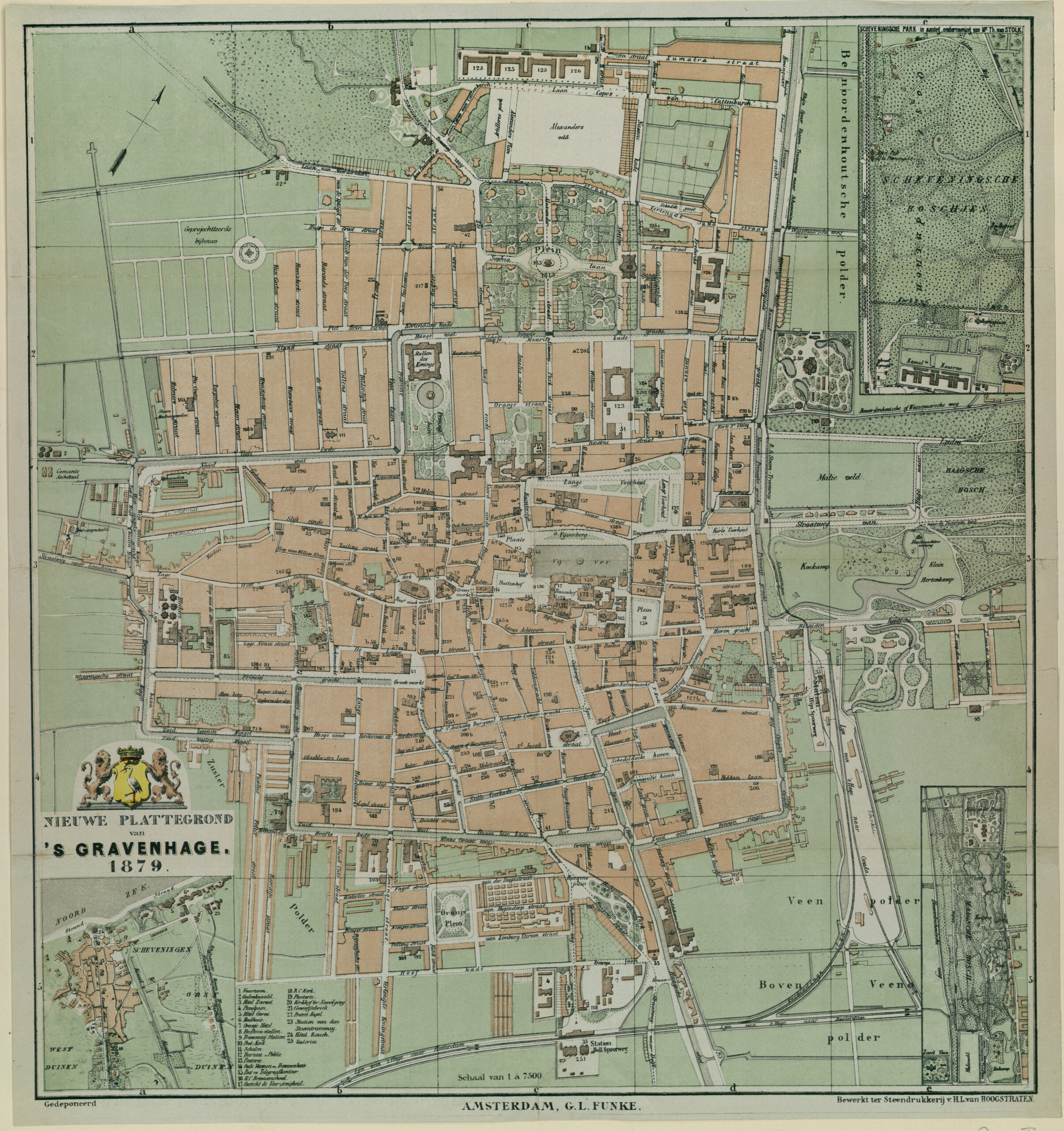
Between 1830 and 1940, the population of The Hague and Rotterdam grew more than twice as fast as that of Amsterdam and theNetherlands (Gemeente ‘s-Gravenhage, 1948), This growth is explained by the fact that Rotterdam and The Hague benefited muchmore from the strong economic growth and industrialization that took place in German cities after the unification of Germany in 1871(Ladd, 1990). Amsterdam and Rotterdam were already cities of size, The Hague was catching up. Compared to 1830, the population ofAmsterdam had quadrupled in 1940, while Rotterdam had eight-and-a-half times the number of inhabitants and The Hague even ninetimes. In 1849 The Hague had 72,225 inhabitants. The number of inhabitants grew to 90,277 in 1869, making The Hague the highestnumber of residents ever. In 1889 the city had 156,809 inhabitants, an increase of more than 200% compared to the year 1849(Gemeente ’s-Gravenhage, 1948: 47). According to the Staats Courant, between 1859 and 1889 the number of wealthy and eligiblecitizens in The Hague (87%) increased much faster than in Rotterdam (14%) and Amsterdam (6%) (Schmal, 1995). Between 1850 and1870 the city would still densify within the canals, after which the city would grow outwards with new residential areas.
From 1870 onwards, the exodus of wealthy citizens from the city center started to the new hygienic residential areas such as the Zeeheldenkwartier outside the canals. The city underwent a transformation from a residential work city to a service city, from a darksmelly water city to a hygienic and illuminated city with shops and offices, but also with the decay of certain residential neighborhoods inthe old city. This change was accompanied by an increase in land costs in the attractive parts of the city, which accelerated that process(Bakker Schut, 1939) (Gemeente ‘s-Gravenhage, 1948) (Stokvis, 1987).
The population growth with wealthy citizens who settled in the residential parks was also reinforced by the special position that TheHague had as an administrative city within the geographical network of Dutch cities. The Hague also offered an attractive livingenvironment with residential parks, luxury warehouses, ‘gymnasia’ and ‘hbs’ (secondary schools of different levels), theatres, seasideresort, beach and societies.
At the turn of the century, the ministries also expanded considerably, so that the share of civil servants in the labor force became increasingly important. There was a large well-to-do civil service, whose influence on the city has hardly been portrayed, but which must certainly have played an important role. The rapid growth of the civilian districts may have something to do with this. Furthermore, more and more embassies and headquarters of companies and trading companies that wanted to stay close to the center of power were established there, especially when after 1870 the trade on the colonies was released by the liberal minister De Waal of Colonies and private individuals were given ownership of Java with the Agrarian Act. Schmal argued that: ‘The growth of The Hague was not accompanied by mass immigration of poor populations. The residence mainly had wealthy newcomers who came to the pleasant living environment that the royal city offered.’ (Schmal, 1995: 187). The well-to-do citizens and civil servants gave The Hague a broad socioeconomic top and a sizeable underclass of caretakers in the domestic service, workers who worked mainly in the care industry and soldiers of the garrison.
In the period between 1859 and 1909, the cities diverged considerably in the occupations of its labor force (Schmal, 1995). The data onthe number of families with one or more servants also showed that there were significant differences between the three major cities. Inthe year 1909 in The Hague 11.7% of the families had a maid and 4% had more servants, in Amsterdam this was only: 7% and 2.1% and in Rotterdam only 6% and 1.8%. But it was mainly the ‘Statistics of Income and Wealth’ that showed the large differences in theassessments of taxes (Schmal, 1995: 198). The new affluent residents had different requirements for facilities, homes and livingenvironment. The need for fashion warehouses and luxury shops, with the latest fashion from Paris, Vienna and Brussels, was great.The proximity of the seaside resort and the beach, the luxurious bathhouse and bazaar on the Zeestraat, the new zoo, panoramas and theatres for stage performances and musical performances offered the new wealthy entertainment. The ‘Sociëteiten’ were the center ofthe social life of many inhabitants of The Hague (Stokvis, 1987).
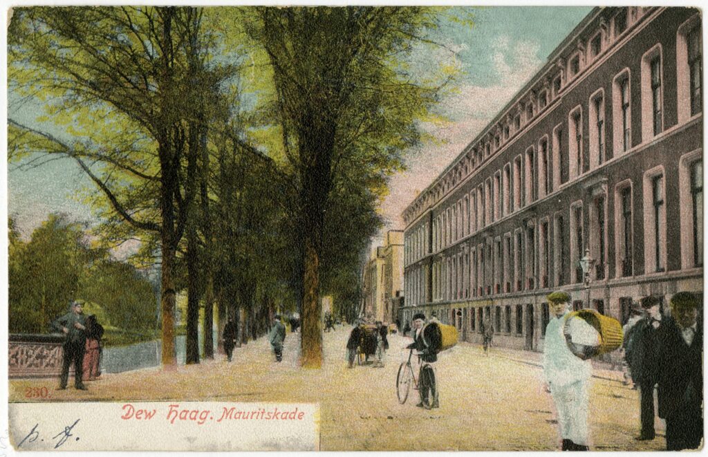
In addition to the differences in facilities and amenities, there were also considerable differences in the type of residential houses withAmsterdam and Rotterdam. In The Hague, mainly large and spacious homes were built for well-to-do citizens and the middle-class.These houses were given a raised first floor with often a beautifully ornamented balcony. Space was reserved for the maid in the atticand at street level in the lower basement with the kitchen: the civilian house as designed by the architect Delia. A house like on the Mauritskade no.43 where the author Louis Couperus was born in 1863.
Capital: crédit mobilier and constructing for the anonymous market
The layout of the first new suburbs and the change in the old city within the canals were accompanied by a new form of financingconstruction activities and therefore of the urban extensions. Because they started producing homes in stock in large quantities, homesfor an anonymous market, entrepreneurs anticipated the type of customer. Was it someone with a well-stocked purse, someone from themiddle-class or were they constructing units for workers?
Obtaining capital for a company was considerably simplified after 1860 when the Crédit Mobilier made a rapid rise in the Netherlandsfrom Paris (Vos, 2003). Large sums of money were invested by new credit banks in private enterprises and urban projects. For exempel,the Comanditiekas in Rotterdam (1861), De Algemeene maatschappij voor Handel en Nijverheid in Amsterdam (1863), De Nederlandsche Crediet en Depositi Bank in Amsterdam (1863), De Rotterdamsche Bank (1863) and De Amsterdamsche Bank (1871).Private individuals organized themselves into Public Limited Companies such as building-land-companies, construction companies and operating companies and gradually gained a significant influence on the development of the city. The role of the municipality wasincreasingly restricted.
Expropriation of real estate for urban development was possible from 1851 but cumbersome, in 1887 the court gained control over it. In1889, a Royal Decree (Koninklijk Besluit) prohibited municipalities from prescribing a mandatory street plan (Stokvis, 1987). Theinfluence of entrepreneurs also increased considerably in the seaside resort with the arrival of the casino around 1884 (Crefcoeur,2010).
The new system of financing came from Paris where the brothers Emile (1800-1875) and Isaac Péreire (1806-1880) with their bank’Société générale de Crédit Mobilier’ had already made numerous investments in railways, infrastructure, insurance companies, gaslighting and newspapers. The idea was to invest directly with large sums of money and participate in one particular industry and nolonger invest a little here and there. The bank thus became mainly a lender that acquired a direct interest in a particular company (Vos, 2003). Many private urban projects, railways, utilities, etc. could be financed in this way. The Crédit Mobilier was also a godsend forhousing construction and urban development in The Hague. With short-term loans one could borrow money at high interest rates fromthe new creditbanks (Bakker Schut, 1939) (Kleinegris & Leferink, 1985) (Stokvis, 1987) (Doorn & Nijs, 2005).
This new way of financing came at a price: the process time played an important role in the construction of houses and urban layout,because entrepreneurs had to pay banks high interest rates over the term of the loan. The interest was deducted from the profits of the companies and therefore there was an urgency to keep the time between taking out the loan and the repayment as short as possible.On the one hand, companies wanted speed in development to limit interest costs, on the other hand, the municipality mainly wantedquality. By slowing down the process, it was able to increase the pressure to make companies more lenient in contributing to urbanfacilities. Furthermore, the municipality required in ’the general conditions for building sites’ that if a company had purchased land fromthe municipality within five years of the purchase, the buildings on these sites had to be occupied. The municipality wanted to preventland speculators from leaving construction sites fallow to drive up the price for colleagues. For many building-land-companies, this wasan obligation that they wanted to avoid, because negotiations with the shrewd engineer and civil servant Lindo and his department couldbe time-consuming (Handelingen van de gemeenteraad 1891, bijlage 16: 3).
The creators of the city
The way of laying out neighborhoods determined what the city would look like. Building for the anonymous market meant that the quality and status of the district had to be determined in advance. The construction of neighborhoods and houses between 1865 and 1902 went as follows. A Limited Company or landowner owned or purchased land. This land was sometimes divided up and placed with different building-land-companies. They produced the street plan with a subdivision in building plots for the buildings. The negotiation process with the municipality was about the costs and quality of the urban facilities and connections of the streets. After the street plan was ready and approved, the lots were sold to construction and operating companies.
However, some building-land-companies sold plots before there was approval from the municipality and so the pressure on the municipality was increased. With short-term credit, the construction company paid for the land purchase, paid for building materials and hired workers. In the event of a bankruptcy of the contractor, it was mainly the subcontractors, workers and suppliers who were not paid. In the nineteenth century, many unskilled workers worked in construction and it often happened that these workers were left destitute in the event of a bankruptcy of a construction company (Gram, 1893, 1906) (Bakker Schut, 1939) (Stokvis, 1987). This practice was the cause of much social misery in the housing and construction sector. The adventurer entrepreneurs have just started a new Limited Company. The money borrowed from the mortgage bank was paid to the contractor in installments. The first term went to the building-land-company and the workers who laid the foundations.
According to Stokvis (1987), in 1911 the municipality of The Hague had a total of 140 contractors and about 1,000 self-builders, occasional contractors: people and companies for whom building was not the main profession. When an entrepreneur had obtained a small capital or could borrow a sum of money at an absurd interest rate, he built another row of houses. Building on credit with a short construction time for the anonymous housing market became common. Anticipatory entrepreneurs who built homes in advance or sold the land for housing pots deliberately exalted the status of a particular neighborhood to lure buyers. These neighborhoods were decorated with ronds-points and more wide streets in the residential area.
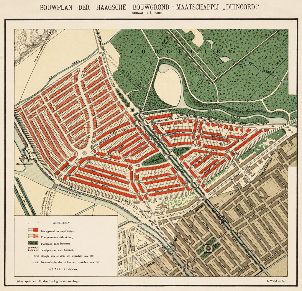
The entrepreneur Scheurleer introduced the idea of living on the sand (dry) and in the bog land with the development of Duinoord. On maps published by his Haagsche Bouwgrondmaatschappij Duinoord the boundary between peat and sand was meticulously indicated to convince residents of the quality of the new Duinoord neighborhood (HGA kl.1119).
The separation between working-class quarters, civilian districts and residential parks was stimulated and reinforced by private entrepreneurs such as Scheurleer. The interdependence of the local government with the owners of the Limited Companies that built the city was great. Especially the council reports with the correspondence between the many Public Limited Companies and the city council between 1870 and 1905 show a shocking picture of the way of urban development.
Limited liability companies came in all shapes and variants such as building-land-companies, construction-companies and operating-companies. Some companies were influential in the city and others did not get beyond one small row of houses. Businessmen with an extensive international network who had enough money to invest were, for example, involved in the development around the Kurhaus and casino, such as Eugène Anselm Jacob Goldschmidt, Louis Guillaume Coblijn and Moritz Anton Reiss (1839-1893) who were partners in the NV Maatschappij Zeebad Scheveningen, founded in 1883 (Crefcoeur 2010). The group around Petrus Josephus de Sonnaville (1830-1925) and assuradeur and municipal councilor for the Liberal Union from 1898 to 1909 Barend Janse Johzn (1847-1916?) also played an important role in numerous iconic urban ensembles, including the seaside resort, the shopping passage at the Buitenhof and residential parks. People who played an important role in the urban development during this period were De Sonnaville, Janse Johzn, Maxwills, Van Stolk and De Lint.
Johannes Antonius de Sonnaville was one of the first councilors and aldermen after 1851. He died in 1860. His son Josephus de Sonnaville initially played an important role in the layout of the Zeeheldenkwartier and the Archipelbuurt between 1870 and 1890. After that, he would focus his activities mainly on the lucrative seaside resort. He was one of the four concessionaires of the Maatschappij Zeebad Scheveningen'(M.Z.S.) and involved in the Société des Galeries, ‘s-Gravenhaagsche Passage-Maatschappij (1876) which had the shopping passage at the Buitenhof built in 1885 by the architect Wesstra. He was also involved in the successor of the M.Z.S. NV Exploitatie Maatschappij Scheveningen (E.M.S.), Exploitatie Maatschappij van Zeerust and NV Maatschappij tot Exploitatie van Hotel Wittebrug.
De Sonnaville, Janse Johzn and Jac. Jenezon, for example, were also commissioners of the Exploitatie Maatschappij van Roerende en Ononroerend Goederen Scheveningen. Janse Johzn was director and supervisor director of Nederlandsche Verzekeringsmaatschappij op het Leven, Nederlandsche Maatschappij voor Electriciteit en Metallurgie and Hollandsche-Belgische Bouwgrond Maatschappij (Belgisch Park).
Janse Johzn was a member of the City Council of The Hague from 1898 to 1909 for the Liberal Union and from 1902 to 1912 of the Provincial Council of South Holland. In 1909, a motion was filed in the Municipal Council of The Hague against Janse Johzn regarding transactions he carried out on behalf of the municipality with the Bouwgrond-Maatschappij-Zandoord (of, among others, Jurriaan Kok, council member and later alderman who had bought land there from Goekoop) for which he would have accepted funds. He resigned from the council for health reasons. With Goldschmidt, Coblijn, Reiss, De Sonnaville and Janse Johzn, international capital gained a face and influence in local politics. Another example is Adrianus Nicolaas de Lint (1838-1894), a material trader from Delft who, like Maxwils, was involved in the development of the Archipelbuurt and the Zeeheldenkwartier.
Neville Davison Goldsmid (1814-1875), for example, showed that urban facilities and amenities were financed on a European scale, whose family was active in London, Paris, Amsterdam and The Hague, in the seaside resort (Lintsen et al., 1993). With the capital of this London and Parisian banking and speculator family, the ‘Compagnie d’ éclairage au Gaz des Pays-Bas’ was founded in The Hague, which had concluded a concession for gas lighting with the municipality for the period 1844-1874, and thereby enforced exclusive rights (Stokvis, 1987). There were major differences between the companies that dealt with the urban development. After the major changes around 1890, Scheurleer and Goekoop in The Hague in particular would be active in the extension of neighborhoods, both with strong ideas about the quality of urban interpretation.
All the companies that dealt with the urban development were Public Limited Liability Companies, a form of legal entity in which the share capital is divided into freely transferable shares. These Limited Liability Companies had the advantage for the partners that there was limited liability for the owners of the shares. For each project (hotels, passages, panoramas, etc.) or urban layout (residential parks, streets, neighborhoods and districts, etc.), a Public Limited Company was established. Hence, most names refer to a location in the city or a particular project. Often several parties worked together in a Limited Company, a kind of construction team in a legal form where each party had one or more shares. The financiers and the landowners often had majority shares (De Sonnaville, Janse Johzn, Goekoop, Scheurleer, Van Stolk), while others, such as architects (Maxwils, Wesstra, Van Liefland), building contractors and material suppliers (De Lint), took a minority share in order to show involvement or to take on the development of a street plan themselves (Maxwils, Van Liefland, De Lint). Everyone shared in the profit and risk of the project.
In addition to the companies that only aimed for short-term profit, there were also those that paid attention to the beautiful city and good facilities and amenities. Delia was already mentioned, but also the engineer and land trader Johannes Bartholomeus Maxwils (1811-1881), who also played a role as a hygienist, and the architect politician Willem Bernardus van Liefland (1857-1919) had a completely different attitude than colleagues such as Vogel, De Vletter and Klomp. Maxwils and probably also the city architect B. Reinders (1875-1890) were relatives of the painter and banker and Hague school painter Hendrik Willen Mesdag (1831-1915) (Groninger Archief, access number: 555 Family Mesdag, 1666-1992). After 1890, Goekoop and Scheurleer also showed that quality was important to attract wealthy buyers to their new neighborhoods. So, there were big differences between the Limited Liability Companies.
If a building-land-company imposed special requirements on the buildings with regard to the image or the construction time, this was done in the land contract with the buyer of the plot. When building-land-companies started with street plans, the municipality also set requirements for these plans. Entrepreneurs then set requirements for the municipality to co-pay for these general facilities or amenities. A situation of negotiation arose between building-land-companies and the municipality about the street plans and amenities of the new neighborhoods, such as with the construction of the Anna Paulowna Park. Initially, building-land-companies donated the land of the public area to the municipality in exchange for the construction of streets, sewers and lighting at municipal expense. However, in the years that followed, the municipality wanted to get rid of these costs and gradually the municipal contributions were reversed. The tension between the building-land-companies and the municipality was therefore constantly present and determined to a large extent the street plans, until the arrival of the Housing Act in 1901. For example, in the dispute between the municipality and Haagsche Bouwgrond Maatschappij Duinoord of entrepreneur Goekoop during the construction of residential parks such as Het Park Zorgvliet (HGA library C k 102 n0. 1-2 from 1902: Het Park Zorgvliet: overprint of the articles concerning this park appeared in newspaper De Avondpost).
Well-known architects such as Van Liefland were involved in many building-land-companies. For example, van Liefland and Simons were involved in the building land company Burgerlijke Maatschappij Bouwlust, which was involved in the slaughterhouse and the cattle market development around 1887 (Simons later became alderman in The Hague) (Nationaal Archief, Den Haag, Ministry of Justice: Centraal Archief Vennootschappen). Van Liefland was also involved in the Public Limited Companies such as: De Toekomst, De Maatschappij voor Onroerende Goederen, ‘s-Gravenhaagsche Bouwmaatschappij and Exploitatie Maatschappij Scheveningen, Bouw Maatschappij Anna Paulowna (Handelingen van den Gemeenteraad 1891, appendix 78: 18). It was conceivable that a renowned architect like Van Liefland owned a minority share in all the projects he worked on to show his loyalty and belief in the project. Together with the architect Wesstra, Van Liefland was, for example, in Zuider Bouwgrond Maatschappij in The Hague where they developed the lands of the widow Pronk (Bijvoegsel Nederlandsche Staatscourant, 4 September 1895, no.207: Naamlooze vennootschap: ‘Zuider Bouwgrond-Maatschappij’ in The Hague).
This way of financing, laying out neighborhoods and building houses for the anonymous market with Limited Companies led to the city image of laissez-faire with residential parks in leafy greenery, fashionable civic quarters with a rond-point and working-class neighborhoods full of slums and epidemics.
On June 24, 1832, skipper Knoester’s fishing boat landed in Scheveningen and, in addition to fish, also landed cholera with an estimated 378 deaths in the densely built-up slums of Scheveningen. Meanwhile, another epidemic had also crept into the slums of The Hague and Scheveningen, typhus. With the city filled with working-class neighborhoods and slums, and the poorly fed new citizens, the number of deaths rose rapidly in the working-class neighborhoods (Schick, 1852) (Krul, 1892) (Oorschot, 2021). It was a miracle when a baby stayed alive.
Conflicts about health, hygiene and facilities 1851-1887
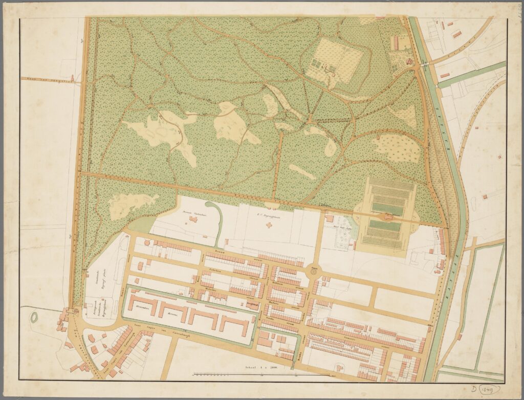
The new city map of The Hague and Scheveningen
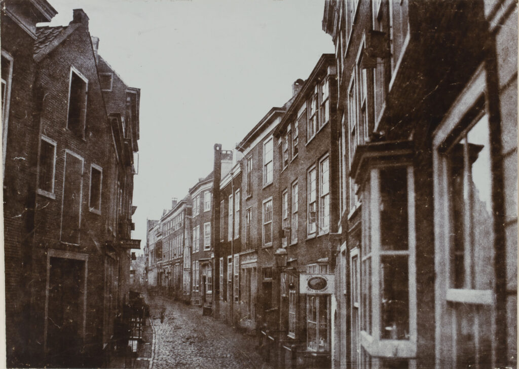
City architect Zeger Reijers (1819-1874) meticulously drew on the city maps in 1833 and 1835 all the great monuments of the city andlinden trees individually on squares and along quays while the slums in the courtyards were left white, as if they were not there. In the second half of the nineteenth century, The Hague transformed from a smelly dark water city into a dry, lit, hygienic service city. This wasaccompanied by numerous conflicts of interest between citizens, hygienists, the city government and the seaside resort. For the inhabitants of The Hague, the miserable life in the slums of the people from The Hague and the Scheveningen in the second half of thenineteenth century was made visible by a new way of drawing city maps by hygienists. In addition to the progressive newspapers, whichconstantly reported on the abuses in the slums, it was mainly the city map and the statistical data that made it visible to residents of The Hague what was going on in the slums in the courtyards. The city image of a hygienic city was born and the entire second half of the nineteenth century would be fought for in order to achieve truly healthy homes and urban spaces with modern architecture and urbanplanning in the twentieth century.
Following in the footsteps of physician Johannes Wilhelmus Schick (1818-1853), whose study Over den gezondheidstoestand van ’s Gravenhage (On the state of health of The Hague) was published in 1852, the city architect Willem Cornelis van der Waeyen Pieterszen(1819-1874), who took office in 1853, had the city maps drawn differently from his predecessor Reijers. During the Restoration, inner areas were preferably not drawn by Reijers cum suis and the city was presented as a collection of magnificent monuments. Thesemonuments were often drawn in revolt or redrawn in the lace decoration. Often, they were enlarged on the city map, so that there wasno doubt about the prominence of the palaces and important urban facilities. For example, the city maps of Reijers (1833), Reding(1837), Van Stockum (1839), Zürcher (1844), brothers Belinfante (1847) testify to this old way of drawing.
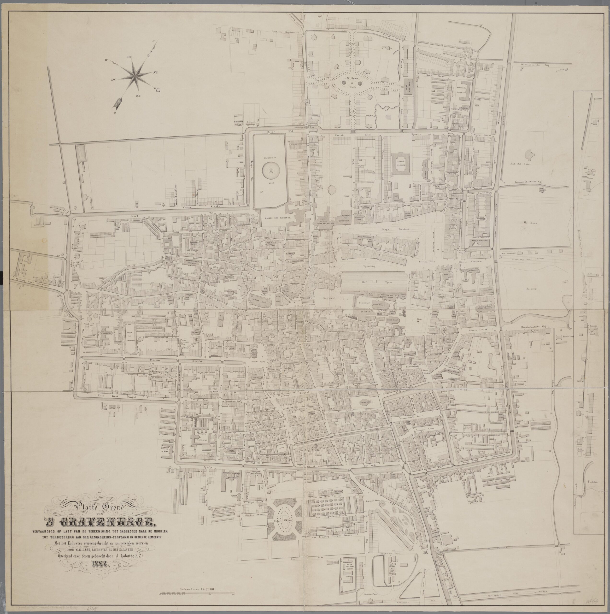
Van der Waeyen Pieterszen broke with this tradition and was the first to meticulously record the slums of The Hague and Scheveningen.These were then used for the new generation of maps of The Hague. For example, the city map by Elias Spanier (1858), Last & Lobatto (1868), Verstijnen & Van der Waeyen (1873) and Verstijnen with the design for a sewer plan (1876). Especially the city map from 1868 measured by C.E. Last, surveyor at the land registry and drawn and stoned by J. Lobatto on behalf of the Vereeniging tot Onderzoeknaar de Middelen ter Verbetering van den Gezondheidstoestand der Gemeente ‘s-Gravenhage (1866- 1872) meticulously showedall the slums. Given the large circulation of the lithographs, these maps must have played a role in the process of raising awareness of what took place in the slums. Van der Waeyen Pieterszen had been concerned about the city’s sewers and drinking water supply for some time and argued: ‘… The need for good drinking water is increased and increased by the alarmingincrease in the construction of courtyards and the accumulation of dwellings and people who have to search for their water in the middleof the city.’ (Stokvis, 1987: 35). This new way of drawing city maps and the enlightened ideas of Schick cum suis must be seen within the social developments and upheaval of the polity with Thorbecke (Oorschot, 2021).
During the second half of the nineteenth century, enlightened citizens increased the pressure on the city government to come up with legislation and urban facilities. But changing the city wasn’t that easy. Certainly not because The Hague experienced explosive growthand there was even a catch-up compared to big cities Amsterdam and Rotterdam. Because after the introduction of the Municipal Act (1851) only very wealthy citizens of The Hague were on the Hague council who mainly tried to reduce municipal expenditure, this washardly heeded. Under pressure from public opinion, the municipality reluctantly granted concessions for utilities, often to foreigninvestment companies that often-demanded sole dominance over this supply as a condition. The city council thought that suchconcessions would reduce expenditure, but it became increasingly clear that it was a very expensive facilities or amenity for the citizens (Bakker Schut, 1939) (Gemeente ‘s-Gravenhage, 1948) (Stokvis, 1987) (Buiter, 2005).
In addition, the coherence between different urban facilities and amenities was complex and the interests were high. All choices in favorof one particular amenity had immediate consequences for other amenity. For the sewer system, a water supply network was needed torealize the flushing system. Sidewalks gave the opportunity to build street sewers. Main sewers were laid in the filled-in canals and tramroutes above them. The Renewal Canal was needed to be able to discharge the sewers at sea, which led to a conflict with the shipowners and the seaside resort. With the construction of the ports, the need to use the canals as ports disappeared and they couldbe filled in. In short, all decisions interlocked.
In 1875 the city architect Van der Waeyen Pieterszen passed away and was succeeded by B. Reinders as city architect who would stayon until 1890. For the engineers and doctors of The Hague, the change of the city was an endless puzzle hindered by its own administration. After 1887, the way was cleared to make urban facilities a municipal task and the city came into the hands of engineersand architects. The city had changed from a smelly dark water town in 1850 to a dry ly lit hygienic service town in 1900, despite the municipal administration.
Conflict between hygienists in The Hague and the city council - 1852
The cat was thrown among the pigeons by physician and hygienist Schick with his publication in 1852. He made a direct connectionbetween soil conditions, urbanization and epidemics with the case of The Hague (Schick, 1852) (Bakker Schut, 1939) (Oorschot, 2021).In his publication, he pointed out the risk of contamination of drinking well water and rainwater because of the landfills and manureheaps in the vicinity of pumps. After the epidemic of 1849, many more would follow. The cholera years were: 1849, 1853, 1854 and1855; and the typhoid years: 1856, 1857 and 1858. The explosive growth of the population, the densification within the canal and the filling of slums were accompanied by continuous epidemics, and that put pressure on the city council to do something.
Everywhere in Northwest Europe, hygienists made themselves heard. Using statistical research, they tried to demonstrate a linkbetween diseases and social differences (Houwaart, 1991) (Ladd, 1990). These hygienists were individual doctors and engineers whofocused on improving public hygiene, public health and the living environment. Equal quality of medical assistance to all was the aim.Insights from England and France, where urbanization had already taken place, were brought to the Netherlands by enlightened citizenssuch as Schick. Schick went a step further and showed with a statistical study in the province of South Holland that, if everyone receivedequal medical care, there were still large differences in people’s health.
There was a link between landscape geomorphology, urbanization, quality of houses and epidemics, Schick showed. In rural areas, themortality rate was much lower than in urban areas. Schick concluded: ‘The observation that the mortality rate in different places, which are spread over a certain extent, shows a very striking similarity, leads to the conclusion that there are circumstances which influencethem over a certain space.’ (Houwaart, 1991). Schick even observed that there has been a significant deterioration since the eighteenthcentury. With his statistical method, he also made visible the causes of the deterioration: inadequate sewers, toxic vapor of canals with rotting substances and stagnant water, accumulation of dwellings in the courtyards, the lack of sanitation, overcrowding, insufficientcleaning of the streets, spoiled drinking water and contamination of the soil with organic substances, houses built directly on the moistpeat soil without it being excavated and replaced by sand, damp building walls, no ventilation and no daylight in the houses in the slums,and canals like open sewers full of impurities.
Schick’s findings focused on geographic space. Schick advocated a technocratic approach to the problems in which the hygienistsshould be given control over public hygiene and regulations for housing and street layout. In addition to the link between the city and disease, the link between drinking water supply and contamination was undeniably established, but the city council was silent and believed that the solution to the problem was found in government abstinence and that the free market did its work in this. Schick’s recommendations for housing construction were: ‘To have all the construction carried out according to a fixed plan, taking into accountthe height of the ground, the nature of the ground, the design of the streets and the distance from the dwellings with regard to the height;In the incorporation of dwellings to take into account good ventilation, lighting, heating and construction of the houses as well as of thesanitation, sewers and gutters; To regulate the size of the houses according to the number of inhabitants.’ However, theserecommendations were also overruled by the city council. In 1853, less than a year after Schick’s research and in the year of the appointment of Van der Waeyen Pieterszen, there was another cholera epidemic in the slums in The Hague and Scheveningen. Theyoung physician Schick himself would die of typhoid fever that year.
The KIVI and the fear of degradation on the civilized classes - 1854
In 1854, by order of the king, engineers from the Royal Institute of Engineers (KIVI) wrote a report on the state of housing, which waspublished a year later as: Verslag aan den Koning, over de vereischten en inrigting van arbeiderswoningen, door eene commissie uit het Koninklijk Instituut van Ingenieurs (Report to the King, on the requisition and interior of workers’ houses, by a committee from the RoyalInstitute of Engineers) (KIVI, 1855). The Hague engineer and trader in building land Johannes Bartholomeus Maxwils (1811-1881), whowould later develop the better parts in the Zeeheldenkwartier and the Archipelbuurt, inspected the slums in The Hague for the KIVI andconfirmed Schick’s findings. In his conclusions, he went a step further and argued that there this was not only the cause of sickness andmisery, but also of immorality, which would eventually affect civilized classes.
‘Limited in space, often poorly lit, imperfectly sheltered from the influence of the atmosphere in damp places and in corridors andalleys, not supplied with the much needed. Without a supply of abundant water, without the discharge of the most hideousuncleanness, the workman’s dwelling is not infrequently a place of terror for the more civilized, where uncleanness sometimesrises to the top, the atmosphere is ruined by all that is piled and rigged, where immorality finds its cradle and cradle, and wherethe foci of diseases arise, whose influence spreads widely around, to attack all classes, and to cause the scourge of destructionto go around into the homes of the more civilized.’ (KIVI, 1855)
The report was not only limited to the old houses but also to new homes, Maxwils complained about the system behind this housingconstruction: ‘Little or no attention was paid to the location and humidity and only intended to build many homes with little money.’ Thehouses were too low, often the wooden floor was only 20 cm above the water, there was no bottom closure, the masonry was poor, therooms too small and too small in height, and there was no air flow. Homes were built too low in unexcavated peat. There was no cleansand layer, no drinking water, no sewer, no sanitations, no daylight and epidemics of typhoid and cholera broke out constantly.
Association for the Improvement of Housing of the Working-class - 1854
A number of prominent citizens and members of the KIVI were concerned about the fate of the people in the slums. In 1854 theyfounded the first housing association in The Hague: Vereeniging tot Verbetering der Woningen van de Arbeidende Klasse.(Association for the improvement of Housing of the Working-class). The driving force was Isaac Paul Delprat (1793-1880), anenlightened officer and engineer who was trained in Paris at the École des ponts et chaussées and was commander of the MilitaryAcademy in Breda and also a board member of the KIVI (Dirkzwager, 1979). The articles of association set out the following ambitions:
’the construction of new dwellings furnished separately for each household, in order to rent them out at a fair price; the purchaseof poorly furnished houses, either so-called blocks or individual dwellings in order to improve them as much as possible and thento rent them out or, if necessary, to resell them; to take all such measures as are within its reach to promote the health of the inhabitants and the potty training, especially by urging improvement in this respect from other owners or from the Government; inconnection with this, to improve the morality of the inhabitants by all means which experience shall designate as effective.’ (BakerSchut 1939: 4).
Later this association changed its name to: Koninklijke Haagse Woningvereniging van 1854. The association included Hofje vanSchuddegeest from 1854 by Saraber, Mallemolenhofje from 1868-69 by Jager and Van der Kamp, Paramaribohofje from 1881 by Wesstra, the 42 residential blocks at Van Hogendorpstraat 52-162 from 1862/69 by Saraber, the Red Village from 1874, the Delprathouses from 1897/98 by Van der Poll.
In the year 1854, a committee of the city council was instructed to ‘Ordinance on building within the municipality of The Hague’ and ’to make a general plan for relatively all the expansion of the city, all the construction of new streets, squares, etc. in order to test allsubsequent plans and applications in this regard against that plan.’ (Baker Schut, 1939).
As argued, cities such as Rotterdam and Amsterdam already had an expansion plan in the second half of the nineteenth century. In1859 Van der Waeyen Pieterszen suggested a Algemeen plan van Uitbouwing der Gemeente (General Plan of Development of theMunicipality), but it did not go beyond partial plans for the Northwest and Southern part, of which due to the ownership relationships andthe impossibility of expropriation, nothing ultimately came to fruition. The municipality itself was too busy with the Willemspark, whichwas built at municipal expense during this period and whose building plots were sold. Just like the expansion plan, nothing came of abuilding code or regulations that Schick had insisted on. Unsurprisingly, at a council meeting in 1859, councilor De Pinto dismissed allthe arguments of the medics and the engineers and opined:
‘I do not dispute that it is very desirable that houses should be built healthy and well, but I may trust that those who have housesbuilt will understand this in their own interest, but it is equally useful to have good clothes and good food. It is not possible toprovide for everything in this matter by Police Regulation. It is said that it is in the interest of public health. I cannot see this: it mayaffect the health of the individual who occupies the house, but it is not so for others. The provisions are very restrictive. Peopleare under illusions, they follow Amsterdam and Rotterdam, where these provisions have been put on paper, but have never beenimplemented, because it was not possible.’ (Baker Schut (1939: 8)
Instead of the intended building ordinance, some very fragmentary regulations were eventually incorporated into the Algemeene Politie-Verordening (General Police Ordinance) (Chapter IV of 1860). It was accepted that there had to be a ratio between the width of a streetand the height of a building. The minimum thickness of the building wall was set at 22 cm and a minimum height of 250 cm for a livingroom was approved. The ban on the construction of back-to-back housing was rejected by the city council by a vote of 28 to 6. The wishthat each house should have its own sanitation was invalidated by a dispensation power of the mayor and aldermen: one toilet perperson for every six houses was included in the ordinance. The regulations on the thickness of the building walls were not declaredapplicable to the slums to be designated by the mayor and aldermen; those of Scheveningen were immediately designated, according toBakker Schut (1939).
Associations for health improvement - 1866-1908
In 1865, sixteen physicians wrote a letter to the city council in which they again expressed their concerns about the health of thepopulation, but this was set aside for notification. A year later, in 1866, the next cholera epidemic broke out. In that year, the Vereeniging tot Onderzoek naar de Middelen ter Verbetering van den Gezondheidstoestand der Gemeente ‘s-Gravenhage(1866-1908) was founded, an association that had a major influence on the hygienic development of The Hague (Bakker Schut, 1939). The association changed its name a few times during its existence: in 1871 it became Vereeniging tot verbetering van de gezondheidstoestand te ’s-Gravenhage; in 1903 Het Hygiënisch Genootschap te ’s-Gravenhage; in 1908 the association wasdissolved. Bakker Schut argued about the status of the association that:
‘Year after year, this association mercilessly exposed the hygienic abuses, and although it could not rely on the approval, let aloneappreciation, of the city council, especially in the first two decades of its existence, one got the impression that it was not leastthanks to it that better concepts of public housing and hygiene began to take hold. The association gave unsolicited advice to the council and in 1867 sent the foundations for a building ordinance to the city council’ (Bakker Schut, 1939: 11).
Important points were minimum street width of 10 meters. Height of the houses does not exceed the street width. Each house musthave at least two rooms, of which one room at least 25 square meters in size. Minimum height living room 3 meters. Separately toilet foreach dwelling discharged into a sewer or watertight cesspool. Prohibition of closet-bed. Obligation to make a waterproof masonry ofdouble baked brick from the foundation to approximate 60 centimeters above ground level. Some demands were met and others werenot. The only physician on the city council, Mr. Dr. P. Bleeker, raised the housing issue again at the council meeting of March 26, 1867.On his ‘cholera map’ all deaths were recorded and located (Van Doorn, 1991: 19). Once again, Bleeker made an unequivocalconnection between housing conditions, geography and cases of illness at the council meeting.
‘And now it has struck me very much that even in the more afflicted neighborhoods, the main streets and canals and moderatelyspacious streets have suffered very little from the epidemic and that the unfavorable mortality ratio even in those neighborhoodsis mainly due to the numerous courtyards, slums and corridors and alleys, often localities with limited airflow outside and virtuallyno air flow inside the house.’ (Bakker Schut, 1939: 9).
Bleeker suggested appointing a council committee to investigate what could be done to improve public housing. The proposal wasadopted and a committee appointed. Bleeker resigned as a counselor a few weeks later and on 7 May 1867 the committee wasdissolved without a vote or discussion in the council (Bakker Schut, 1939:9) (HGA bnr 0036, inv.nr 1-39 ‘Vereeniging Verbetering Gezondheidstoestand’, 1866-1908).
General Police Ordinance - 1871, 1876, 1878, 1884, 1892
Between 1866 and the advent of the Housing Act in 1901, the associations of hygienist were able to amend the Police Regulations stepby step with constant pressure. In the years 1870 and 1871, smallpox epidemics broke out again in the slums. Two years later, in 1873,there was another cholera epidemic. It was not until the General Police Ordinance of 1871 that the flawed bylaw of 1860 was revised.The Association for the Improvement of Health Status was disappointed in this reluctant admission and turned to the city council again,but was not heard. Nevertheless, two articles 44 and 45 were included that would become important for the city, according to BakkerSchut (1939: 12). ‘No one may build higher in new streets than determined for each street by the City Council. No one may build a streetexcept to be determined by the City Council on its width and in the direction.’
In the street layout after 1875, articles 44 and 45 on the city interpretation of the General Police Ordinance of September 19, 1871 and June 20, 1876 were incorporated in council reports and agreements between the municipality and the building-land-companies. Thesestandards applied to all neighborhoods. However, there were no monumental ronds-points with fountains or beautiful streets with linden trees in working-class neighborhoods and the streets there were often narrower than the police ordinance prescribed. Ten meters or lesswas common, while twelve meters was the prescription. In the layout of streets, various articles of this ordinance from 1871 would playan important role. These were provisions that related to the size of the street and height of the façade, but what took place in the courtyards and the slums, was still considered of no importance by the council.
Another article, labeled as eccentric by Bakker Schut, dealt with toilets. In doing so, the old dispensation power was repeated by themunicipality. Each home must have a toilet unless one has a permit to make a common toilet for every six homes. The associationopposed this article which gave a dispensation power. This was a continuation of the old policy; the Criminal Procedure Commission ofthe municipality gave the following curious answer: ‘The Commission dares to express the opinion that one toilet for every six small houses outside in a narrow environment is healthier than having such an opportunity for every small house inside.’ The associationresponded to this curious statement that one toilet for six homes meant, one for twelve families, one for every sixty persons. However,the council accepted the opinion of the Criminal Procedure Commission.
At the urging of the Vereeniging tot verbetering van de gezondheidstoestand te ’s-Gravenhage, the first building regulations weredrawn up in 1878: ‘Regulation regulating the building police’. For the first time, doubts were also expressed in the city council about theHague courtyard system. Councilor Rietstap argued on April 10, 1877 that the first courtyards were founded by friends of people, withthe aim of meeting the needs of less fortunate fellow citizens. The courtyards of the new age, on the other hand, are merely means ofspeculation and exploitation. From now on, building plans for courtyards had to be submitted to the municipality for approval. Thedistance between the facades had to be at least 6 meter and the height of the living quarters at least 260 centimeters. People wereallowed to build houses back-to-back, a gate to the courtyard was allowed and the communal toilet per six houses remained the rule.
In 1882, a committee from the association consisting of Dr. Carsten, Ir. D.E.C. Knuttel and Dr. A.H. Pareau reported on the changesdeemed necessary in the revision of the regulation. The Criminal Procedure Commission, when the Ordinance was revised in 1884,informed the association: ‘and with regard to the further construction and interior of dwellings, the Commission considered that, however desirable it may be, that the health measures recommended by the addressees should be observed, the prescribing of such measures, under threat of punishment, would be highly restrictive and impossible to maintain, since it would restrict the freedom of residents in avery questionable manner. As long as the need to restrict freedom in the public interest has not become apparent, no further than isnecessary may be taken in this respect.’ (Baker Schut, 1939: 13). That is the liberal position of the committee. In a new revision in 1888, only an access of 250 centimeters wide and 300 centimeters high was added to the articles of the ordinance, otherwise everything interms of building legislation remained the same.
In the year 1892, during a revision of the police ordinance, article 41 of Het Stedelijk Keur of 1841 was abolished, the law that left the building in the courtyards and in the meadows to the free market without regulations and subjected the facades on the streets andsquares to all kinds of requirements. Het Stedelijk Keur was replaced by an article that prohibited ‘building other than on streets, laid outon site, according to the dimensions in the direction and at the height determined or approved by the City Council.’ (Baker Schut, 1939:13, 14). They were not allowed to build more than ten meters behind the building line. After 51 years, construction working-class units and slums in courtyards and on empty meadows came to an end. A year later in 1893, the journalist Gram argued about the livingcondition:
‘So, a lot depends on whether the Hague City Maiden is seen first from the front or from the back. … Dr. Pareau, who recently in The Hague press denounced the layout of the numerous narrow and musty alleys with low workers’ houses, so-called ‘courtyards’, on hygienic grounds disapproved, found in all these iniquities reason to compare the court city with someone whoonly washed face and hands. There is much truth in this witty chosen image. Indeed, The Hague City Maiden needs the spaciouscloak of love to cover it, which is neither beautiful nor attractive. She appears neat and elegant, kind and brightly, but when shecarelessly lifts her tunic a little high, things come up that make you blush greatly.’ (Grams, 1893: 18, 20).
Coal, coke, gas lighting, sanitation, electricity and communication
As for utilities, which also covered the better parts of the city, the city government was more lenient than it was regarding regulationsregarding the health of city dwellers. Around 1840, the open fire of wood and peat was replaced by stoves, stoves and cooking stovesthat burn coal with a significantly higher energy yield. Gas could also be made from coal, which was important for street lighting. Theresidue left behind during degassing was called coke fuel. As early as 1774, the streets of The Hague were illuminated with 1659 oillanterns. In 1820 the first gas lighting appeared on the Binnenhof (Stokvis, 1987).
In 1843 a concession was granted for thirty years for municipal gas lighting to a stooge of the Anglo-French banker and speculator Neville Davison Goldsmid (1814-1875) and his ‘Compagnie d’ éclairage au Gaz des Pays-Bas’ established in Paris in 1844. The Goldsmid family was active in Paris, London and The Hague and had ties to the Rothschild banking family. The company was given amonopoly in The Hague for thirty years over the supply of the running gas, which ultimately cost the municipality dearly. The companyinstalled 880 gas lanterns at its own expense and the operation came to 40,000 Dutch guldens per year, at the expense of themunicipality. High costs and low quality were the result, according to Stokvis (1987). The municipality negotiated and litigated in vain.Goldschmid demanded three million guilders for the redemption of his concession. Around 1870, Goldsmid’s gas factory was built on theLijnbaan, where coal was processed into gas. In 1875, the concession finally expired. In that year, 2900 private customers spent morethan three times as much money on gas as the municipality.
Already in 1872, the municipality decided to set up its own gas company. Under the leadership of director J.E.M. Kos, a new municipal gasworks was built on the Loosduinseweg-Gaslaan in 1875, which began supplying municipal gas in June 1876 at a much lower price.Due to the arrival of gas stoves, the consumption of gas in the new neighborhoods increased significantly and coke and coal graduallydisappeared. In 1880 the old gasworks of Goldschmid on the Lijnbaan closed. Gas was not only used by the municipality and privateindividuals, but especially by companies that worked with gas engines. With the introduction of the coin gas meters by the year 1900, the less well-off citizens were also connected to the gas network. Due to the urban expansions, the municipality decided in 1904 to buildthe second gas factory along the Trekvliet in the Bickhorst. In 1907 it was completed and this factory was accessible to cargo ships with500 tons of coal. The First World War caused problems with the supply of coal in The Hague and these were therefore rationed.Gradually, the gas extracted from coal disappeared and was switched to electricity. In 1917, coal was so scarce that even municipal waste incineration connected to the municipal power plant.
Stokvis (1987: 38) reported that the gas lanterns were only placed in the better neighborhoods. However, Van der Haer (1968) collectedphotographs from the period 1860 to 1870 and showed that the lesser districts were also provided. Almost all urban spaces in the oldcity and new neighborhoods were illuminated, including smaller streets such as Bleyenburg and Maliestraat. The slums in ScheveningenWest, such as the Wassenaarsestraat near the Seinpostduin, were not illuminated. Another book with photos from the end of the nineteenth century also shows that alleys were equipped with gas lanterns, such as the Schapensteegje around 1895 (Nieuwenhuijzen & Slechte, 1975). Other urban spaces, such as the Lage Zand, were still unlit by 1900. A slop at the Westeinde also had no lighting. Thelesser neighborhoods, such as the old Slijkeinde and the new streets, such as the working-class streets Haveriusstraat andJacobastraat, were illuminated at the turn of the century. It could be said that around 1870 the city was completely illuminated with gaslight, apart from the slums in courtyards that were still in darkness (HGA bnr 0452 ‘Raadscommissie ad hoc omtrent de aangelegenheden der gasverlichting’, 1873-1879).
In the newspaper De Opmerker of 1867, four articles by Van der Waeyen Pieterszen appeared in which he described plans for anintegrated sewer system in The Hague on a flush basis with steam pumping stations. The rinsing water would have to be supplied bythe city bosom, but a drinking water network was also needed to flush the sewers of the houses. The waste water of the sewers wouldthen have to be directed to the dunes as fertilizer. Unfortunately, they remained intentions (Buiter, Riool, rails en asfalt: 80 jaar straatrumoer in vier Nederlandse steden, 2005).
In addition, there was disagreement in The Hague about whether to install an integrated sewer system based on water flushing or the Liernur system in which faeces were sucked out of the piping system by means of negative pressure, for which no water pipes would beneeded. Still, the malodorous canals and dirt in the streets must have troubled the gentlemen of standing. The beautiful city image wasmarred and the city council decided that this junk had to be picked up. Private individuals who tendered the lowest in the tender pickedup the dirt in the city by handcart and barge and deposited it outside the city (Stokvis, 1987). This was not always done carefully and in1871 the municipality took the city cleaning into its own hands. The cleaning service was equipped with new equipment: horse and cartentered the service. The stench of the canals, the epidemics, the system of partial sewer systems with settling pits and discharge to thecanals remained a problem. From 1908, dump trucks were put into service and in 1912 the first garbage trucks appeared, first onelectricity and later with gasoline engine (HGA-bnr0394 ‘Gemeentelijke reinigingsdienst’, 1871-1969).
The construction of a drinking water supply network was promoted by the Vereeniging tot verbetering van de gezondheidstoestand te ’s-Gravenhage (HGA-bnr0395 ‘Ingenieur van den eerste aanleg der Duinwaterleiding’, 1871-1874) (Stokvis, 1987). Finally, in 1873,money was borrowed for the construction of this facility. Previously, public wells, pumps or lead-lined cisterns were used to collectrainwater. Small households involved hot water at water and fire stores. As early as 1863, several private concessions were applied forbut not granted or realized. After proposals by councilor De Pinto for municipal construction were rejected in 1866 and 1869, hisproposal was accepted in 1871 by 18 votes to 11, while two years later it was also decided that the municipality to operate the system. Under the direction of the chief engineer of the State Railways J.A.A. Waldorp and the Norwegian engineer Th. Spang, trained in Liège, the construction went well in 1874: in January 1875 there were already 1002 connections.
Foreign entrepreneurs also played a key role in this facility. A London firm laid the pipes. In 1874 the total length was 64,000 meters andin 1912 almost five times that. Consumption increased faster than expected due to the installation of fire hydrants in the city and the annual rate for homes that was adjusted to the rental value.
Only when waste was prevented by regulating the pressure and in 1884 the collection in open canals gave way to fine sand drainage in the dunes, which also reached deeper from 1890, did municipal exploitation of drinking water become profitable. The water supplynetwork from the period 1873-1875 made the integrated flush-based sewer system possible. Now the houses with water connectionscould also flush the sewers. A map from 1874 is known on which a sewer system was drawn in 1876 by the city architect Reinders, witha pumping station to discharge water into the sea; a refined sewer plan, in which all streets of the city were given a sewer (HGAgr.2030). On October 14, 1879, the city council decided with a narrow majority not to build a sewer system but large sinkholes in the Spui and Prinsegracht to be filled in (HGA-bnr0451 ‘Raadscommissie tot onderzoek van het riolenplan of rioolstelsel’,1875-1887).
As early as 1876, the International Bell Company requested that a telephone connection be established and operated. In 1880 thecouncil considered this request. According to the pre-advice to the city council, the municipality did not need such a facility, but somecouncil members thought very differently (Stokvis, 1987). Bell’s Dutch subsidiary was prepared to invest in the overhead lines, but inreturn demanded the exclusive right for a number of years. In 1883 there were already 116 telephone connections and when theconcession expired in 1897 there were 607.
After many meetings and much opposition from the city, it was not until 1902 that it was decided to operate the municipality. Thetelephone service became an independent municipal company that expanded rapidly. Cables came together in telephone towers thatwere connected to the telephone exchange with an underground cable. In 1903, the municipal telephone service already had 2032connections and became a profitable municipal business. In 1885, W.J. Wisse, deputy director of the Rijkstelegraaf, received a limitedconcession to build a power station. The Hofsingel power plant, completed in 1889, was taken over by Siemens in 1891. Consumptionwas small-scale and some companies and hotels had their own power stations.
Municipal electricity production was decided in 1904 on the proposal of N.J. Singels, who switched from Siemens to the municipalservice in 1901. A.E.G. Stork built a three-phase power station and the Cologne company ‘Land- und Seekabelwerke’ built a tram cablenetwork. The Municipal Electricity Company (G.E.B.), founded in 1906, aimed at a broad market with low rates (Stokvis, 1987). Thenumber of electric light users increased from 372 in the year 1907 to 10,000 in the year 1918. In 1917 it was decided to electrify thepublic lighting, which was completed in 1919. In the First World War, due to a lack of coal supply for the gas, all gas engines were alsoreplaced by electric motors. Finally, in the year 1915, rental homes were also connected to the mains with free coin meters and indoorpipes (HGA-bnr0452 ‘Vaste raadscommissie voor het Gemeentelijk Gasbedrijf en Gemeentelijk Electriciteitsbedrijf’,1880-1915).
Conflict between city and seaside resort over the Refreshment Canal - 1887-1890
After 1887, citizens and city administrators were given the same interest: a clean hygienic city. Stench and disease still caused a constant call for a proper sewer and water supply system and the filling of all canals and ditches, despite the fact that the drinking watersupply had already improved. The main problem was that all partial sewer systems came out in canals of the old city and the flowremained stationary there. With the city’s most expensive project, the Refreshment Canal and the Steam Pumping Station, the city’s muck had to be discharged into the sea. The Vliet, the canal between Delft and Leiden was thus connected to the sea. Constructionbegan in 1888 and was completed in 1891. The canal came into the sea far south of Scheveningen. With the new Laakhavens it wasalso possible to take shipping out of the old city, so that the last smelly canals could be filled in. The waste would be discharged into the canal via sewers and then pumped into the sea. The Hague wanted to reverse the natural flow direction of the water from the dunes tothe hinterland.
In 1890, however, the municipality came into conflict with the seaside resort and the fishermen over this intention to spout. Especiallythe mighty Maatschappij Zeebad Scheveningen (M.Z.S.) with its investors from Paris, Antwerp and Amsterdam was strongly opposed to this and wanted to prevent spouting during the bathing season from Pentecost to October 1 (Vegt, 1889).
During a session of the city council in 1890, municipal Secretary Evers argued that in the bathing season of 1889 it had beendemonstrated that discharge outside the bathing season was sufficient to clean the canals in The Hague and that the seaside resort didnot suffer any damage and contamination. Councilor Van Malsen noted that the sea locks had to be kept closed in the summer becauseinsufficient water could be extracted from Delfland. At this council meeting, the motion to end the discussion was rejected.
The newspaper Algemeen Handelsblad of 11 January 1890 described the dilemma of summer spouting. It was the interests of the residents in the wet parts of The Hague versus those of the seaside resort. Numerous scholars were consulted by different parties andopinions varied widely, but the council did not reach a decision. There was no flushing in the summer, with all the consequences thatentails for the city. The seaside resort and seaport were represented by two excellent lawyers and scholars: Mr. Fynje, former citycouncilor, expert on watermanagement and committee member, who dealt with the sewers of The Hague, and the Utrecht professor dr.Overbeek de Meijer. According to these specialists, the refresh canel was of no use and the problem would not have been solved withflushing the dirty water system. The Acts of the City Council of 1890 documented all these objections (Annex 4: 1-2; Annex 12-14: 4-10;Annex 17: 11-12, etc., Annex 103: 46-47).
Even German newspapers such as the Frankforter Intelligenz-Blatt and the Vossische Zeitung from Berlin paid attention to the ‘Haguespuiquaestie’ and the contradictions in the city, according to Acts of the City Council of 1890 (annex 318: 121-122). Did the interests of anumber of bathers have to come before the interests of many in the city? The canals remained gathering places of dirt, scholars argued, and the only one to be harmed was the seaside resort, which was threatened with destruction. The scholars prescribed that there wasno need for spraying in the summer months. However, the newspaper argued that all residents of The Hague knew better: that with asolid continuous discharge ’the atmosphere air is pure and the water is fresh flowing.’ According to the council’s acts, the newspaperfurther argued: ‘The interests of the residence far exceed those of Scheveningen, just as the interests of 130,000 souls far exceed thoseof 18,000.’ Nevertheless, the newspaper recognized that the interests of Scheveningen were also the interests of The Hague andconcluded that a trial with summer flushing would be carried out.
The Algemeen Handelsblad of 31 January 1890 reported a meeting of the Vereeniging tot verbetering van de gezondheidstoestand te ’s-Gravenhage about the long-term spuiquaestie. The association strongly urged the municipality to continue to discharge into the sea via the Verversingskanaal during the summer months. However, the council was not yet convinced of this. The association thereforewanted to take the matter to court. In any case, she wanted to stipulate that during outbreaks of an epidemic, flushing of waste water was carried out in the summer. In the Algemeen Handelsblad of 26 February 1890 a report appeared about the council meeting of 25February in which the long-running case, which mainly took place during the bathing season, was once again discussed. In the Nieuws van de Dag of June 12, 1890 it was reported that during the general meeting of Zeebad-Scheveningen the director-general of the Kurhaus was questioned and asked what legal measures would be taken against the municipality if the waste water was flushed into the sea. The announced measures against the municipality were: ‘dissolution of the leasehold contract and compensation for all damageand interest.’ A competent lawyer had been heard and believed that the case was favorable to the Zeebad.
Finally, on July 15, 1890, according to the Acts of the City Council 1890 (annex 320: 122-123), the council decided that flushing couldalso be carried out in the summer under strict conditions, but ebb and flow, wind direction, etc. had to be taken into account. The Vereeniging tot verbetering van de gezondheidstoestand te ’s-Gravenhage continued to work unabated for the filling of the canalsin The Hague and the discharge into the sea during the summer season. In 1891, a report from the association appeared showing thatbetween 1866 and 1874 the number of deaths of people living along the canals and ditches was higher than in other places. In additionto the request in 1891 to the council according to the Acts of the City Council 1891 (annex 458: 164) to fill in the Nieuwe Haven and the Turfmarkt, the association proposed to also fill in the Spui, the two Veerkaden and the Paviljoensgracht.
The Laakhavens and the connection to the Verversingskanaal were dug between 1901 and 1902. This created a spacious inland portalong the railway and roads of the city. The port of Scheveningen was built between 1898 and 1904, after a storm destroyed the fishboats on the beach. New industries were established in the Laakhavens, such as the slaughterhouse on the Neherkade and the gasfactory in the current Binckhorst.
The new city architect Isaac Anne Lindo (1848-1941) had gained extensive experience with ports and waterworks in Japan and tram/railways in the Netherlands (Lindo, Eenige mededeelingen over ‘s-Gravenhage in 1885 en 1910, 1911) (Lindo, Dagboeken, 1910-1919) (Everts, 1918) (Maarschalkerweerd, 1998) (Neve, 2000). Large ships could now call at The Hague and supply coal for the gasfactory, for example, while transporting industrial products from the Schilderswijk, Rivierenbuurt and Kortenbos. Fishing also developedand with it the type and dimensions of the fishing boats.
Initially, only small boats (bomschuiten) entered the port, but after the completion of the second port of Scheveningen in 1903, largerboats (loggers) could also enter. All the need for skippers to enter the city by boats had fallen by way and the last open canals werefilled in. Prinsegracht first part (1879), Amsterdam Veerkade (1901), Stille Veerkade (1901), Paviljoensgracht southern part (1901), Prinsegracht second part (1902), Brouwersgracht (1902), the canal between Turfmarkt and Houtmarkt (1903), Spui last part (1903) (Havelaar, Horst, & Kler, 1998).
It was not until 1897 that the first flushing sewerage system was built in The Hague, starting in Scheveningen, where there were nocanals. In order not to ruin the seaside resort, the sewage at the Verversingskanaal was pumped into the sea at a great distance fromthe beach with a siphon press pipe. That was around 1917, when there was already 300 kilometers of sewer in The Hague, as much asthe drinking water network needed for flushing.
Around 1900, all facilities were in municipal hands and products such as gas, electricity, telephone and drinking water could be offeredto its citizens at a reasonable price. These facilities were taken into account in new street plans.
Fear as a motive for the reluctant changes 1851-1887
Why did the reluctant city administration and council get to the point of making concessions on building laws and facilities? After all, thewealthy voters lived on the sand on the better side of the city. This question occupied the social historian Stokvis (1987) and the civil servant Bakker Schut (1939) in their studies of the nineteenth century in The Hague. Maxwils’ words had not been forgotten: ’the fear ofencroachment on the civilized classes’.
Stokvis described the riots in the second half of the nineteenth century. For him, these were partly an explanation for why the citycouncil, after deliberation, reluctantly gave in with regard to urban facilities and building legislation. Despite the vigilantes, equipped withsabers and rifles, and the coalition ban that applied in The Hague until 1872, there were several violent riots by fishermen and slopdwellers. Around 1870, workers, office workers, and lower-level civil servants organized themselves, despite the coalition ban. A militantlabor movement developed and a newspaper like De Ooyevaar reported on the abuses all the time, despite the fact that journalistsusually disappeared into prison. In September 1872, The International Workingmen’s Association also established a subsection inThe Hague. There was a nervous reaction and there was fear of new social unrest. The political agitation reached a peak with twonewspapers in The Hague: the radical democratic magazine De Toekomst and the socialist weekly De Vrijheid, which began to circulatewith the proclamation of the Commune in The Hague in March 1871. The Fifth Congress of The International Workingmen’s Association IWA, began in September 1872 in dance hall Concordia in the Lombardsteeg Kortenbos The Hague and aroused evenmore unrest among the conservative press and the Orange-minded public, but eventually ended in a class between the anarchistMikhail Bakunin and the communist Karl Marx. Workers in The Hague opted for anarchy instead of a Marxist organization.
Bakker Schut also pointed to the fear as a motive to give in step by step and to improve the fate of the less wealthy in the city. Hequoted from Helene Mercier’s book Over arbeiderswoningen (On Workers’ Housing) (1886), which described the NederlandscheNationale Vereeniging van Werklieden. This association was founded by conservative Protestants in protest against ’the FirstInternational’ with the aim of: ‘removing well-meaning workmen from the influence of socialist ideas.’ The workmen who registered as members had to sign a declaration: ‘The Dutch workmen continue to rally to the throne of the Orange tribal house, as the pillar of Dutch existence and to the altars as representing the religion that constitutes the essence of man.’ (Quote Mercier by Bakker Schut 1939: 14).The association was a corporation that built housing for the workers who rejected socialism. For many wealthy citizens, such asindustrialist and the local councilor Van Enthoven, there was an indefinable fear that led them to do ‘something’.
Maxwils already noted that disease, misery and immorality in the slums were ultimately a threat to the entire civilized classes. Thecontinuing uprisings worried the prosperous bourgeoisie. The huge garrison around the Hofkwartier, with troops and horses, ensuredpeace and order, but for how long? With that garrison, the charity courtyards, the orphanages and facilities such as the Foundation of Renswoude, which gave orphans from The Hague an education, the many arrests of journalists and rioters, and with the spawning ofgodly and royalist workers, riots were nipped in the bud in time and the worst in The Hague was prevented.
However, it was mainly the engineers and doctors who gradually transformed the smelly dark water city into the dry lit hygienic city,despite the interests of most council members and the college. The industry disappeared around 1890 and from that moment on, TheHague grew into an orderly hygienic service city with attractive facilities.
The lack of historical awareness and boring architecture
The lack of historical consciousness and national identity
Not everyone was pleased with the brilliance of the Willemspark, the Zeevillas, the white villas in the Van Stolkpark and Belgisch Park orthe plastered Ministry of Colonies (1859/61) and the cast iron façade of the Supreme Court (1861-1938) of government architect W.N. Rose (1801-1878) on Het Plein. The Hague Drawing Academy, where the spirit of Reijers still floated, also underwent a major cleaning.There had been a discussion for some time whether the Drawing Academy should be purely an art or also a technical education, it wasconsidered to association the existing industrial school with the architecture education (Lottman, 1984). In 1859 the Academie van Beeldende Kunsten en Technische Wetenschappen (Academy of Visual Arts and Technical Sciences) was founded with a.o. Van derWaeyen Pieterszen, Delprat and Noordendorp on the board. Vogel as head teacher of construction sciences and Saraber for ornaments and architecture. As early as 1863, the Secondary Education Act had been enacted to provide for drawing education in secondaryschools, the Academy became superfluous. In 1866, The Hague received the first civilian day and evening school in which all subjectstaught at the Academy were taught. De Stuers would further separate art education from the Ministry of Education and set it to his liking (Bank & Buuren, 2000).
In De Opmerker of 28 April 1866, the weekly magazine for construction and architecture, there was a letter in which criticism was madeof the commission for the Palace of the States-General to the Government Architect and Rotterdam architect Willem Nicolaas Rose(1801-1877). Rose’s work and buildings by Hague architects such as Saraber and Delia were heavily criticized.
‘We consider the works of Mr. Metzelaar and Godefroy too high to dare to compare them with those of Mr. Rose; but we fear tofind in the new Palace for the States-General a family trait with the unfortunate façade of the Ministry of Colonies or the characterless façade of the Building for the High Council. Mr Rose may have his merits and certainly has them, but we disputehim as an architect. Whether one has an eye on the monuments built and plastered by him in the Residence, or on the villas in the Willemspark there and on the beach in Scheveningen, the house of invalids in Arnhem or the so-called restoration of theLottery Hall in The Hague, in none of these one discovers any art value, and, what is more, It is sad that the making of designs forso many important buildings has been entrusted to such hands.’ (De Opemerker, April 28, 1866: 1)
Later in De Opmerker of 28 April 1866, the columnist Crito spoke in Letters From the Residence about the ‘Parisian or Brussels fashionforms’ used in The Hague and about the loss of national identity. In De Opmerker of 29 December 1866, architects from The Haguewere strongly reproached by an unknown letter contributor who quoted the newspaper: ‘We always like to talk about the architecture inthe Hofstad {The Hague], because there is much to reveal and remark about The Hague and its buildings; many a ‘great club’ lives there and from there many judgments go out, up to and about the ‘noblest of the country’, as witnessed by The Hague chronicler who says in the Algemeen Handelsblad of 20 November 1866: ‘It is a pity that we actually have almost no architect in the whole of The Hague.’ … ‘InAmsterdam, people know how to bring character to the new extensions.’ … ‘Here is the patchwork without style or taste, papier-mâchéhouses’ … We have never read greater oracles in a newspaper. There is hardly any architect in The Hague! And structural engineerslike Mr Rodenburg, Mr Vogel, Mr Pieterszen, Mr Camp, Mr Saraber, Mr Rose, Mr de Vletter? What are they all? Are they ‘almostarchitects?’ no, they are architects in the fullest sense. In Amsterdam, it’s good there first, it’s no patchwork, no papier mâché,’ accordingto the unknown letter contributor.
In the period of nation-building in the nineteenth century, many countries in Europe resorted to their own variants of the Renaissance.They began to document and analyses their own monuments and, on the basis of these analyses, sought a single national style thatcould serve as a historical guideline for and legitimation of the nation for the population. According to the architectural historian Aukevan der Woud, an important change in the thinking of Catholics, including De Stuers, Alberdingk Thijm and Cuypers, took place (Woud, 1997).The political space that liberal ones such as Thorbecke had created caused emancipatory movements to flare up and brought new ideas about, among other things, architecture. From the old view that architectural style originated from the people to the reverseidea that style had to be imparted to the people from above. The imposed architectural style was not a personal invention of masterbuilders (the maligned individualism) but a return of a common and precious possession that had fallen into oblivion and decay due to ignorance. This also meant a radical break with the ideas of the liberal politician Thorbecke who believed that art was not a matter forgovernment.
The inspiration for De Stuers and his circle was in that national past, that time when the arts were still flourishing and emerged from anatural and united need for beauty, according to Van der Woud. It was precisely the ignorance of one’s own history that was the cause ofthe adrift and moral decay of the population in the slums, de Stuers thought. In 1875 he gave two reasons why emphasis should beplaced on Old Dutch in architecture. First, the taste of the people would be ennobled and civilization would be developed. Secondly, the restoration of old buildings would have an ‘incalculable’ benefit for the architects, because their taste and their technical knowledgewould improve and increase. According to Van der Woud, the lover of old architecture, the Amsterdam architect Abraham NicolaasGodefroy (1822-1899) pointed to an important element that would long be associated with the ‘Old Dutch’ style, namely the cultivation ofso-called typical Dutch values such as: the simple, the sense of calm, austerity and balance, and the aversion to passion, pageantry andsplendor. Godefroy argued:
‘In our time it is felt that more and more, as a result of which the so-called natural style, with the undisguised application ofnational building materials and visible construction, is being practiced more and more, while at the same time carefully gatheringwhat was done in that direction by our forefathers.’ And ‘Which of the direction outlined above can now be considered the actualnational ones, we declare that we cannot determine. The most characteristic of our country is the mixed baking and mountainstone construction of the early seventeenth century, but we fear that the reintroduction of this style would be met with manyreservations by the builders.’ (Quote in: Van der Woud, 1997: 109).
Following Semper and Violet-le-duc, De Stuers presented construction as leading to form principles and architectural forms. Thedisregard of this ’truth’, that architecture is first and foremost construction and that any form or ornamentation that was not motivated bythe construction or was not compatible with a good construction had to be rejected. The use of material that was not in accordance withits intrinsic properties testified to backwardness. Brick had to be used as a brick and not plastered blocked, as with Delia and Saraber.Wood had to be wood and not cast iron as with Rose. If natural stone was used, it had to be visible and if plaster was used, then it wasplaster and could not be marbled.
It is striking that fellow believers who would play an important role in The Hague at the end of the nineteenth century lived or workednear each other. De Stuers lived in the mansion of the architect Delia at Parkstraat 32-34. Diagonally opposite the church underconstruction in the Parkstraat of his friend Cuypers where the young architects Van Liefland and Molenaar took care of the supervisionand drawings during the construction. Goekoop lived a little further in the Willemspark and then at the Catshuis, Scheurleer lived on thecorner of Canergielaan 16 and Laan van Meerdervoort 53F a stone’s throw from De Stuers and Goekoop. Lindo lived at Laan vanMeerdervoort 50 in a house that could have belonged to Delia.
De Stuers, Gugel, Cuypers, Goekoop en Scheurleer and Dutch neorenaissance
In an article in De Gids, ‘Holland op zijn smalst’ from 1873, the founder of Dutch cultural policy Victor Eugène Louis de Steurs (1843-1916) mentioned numerous examples of neglect of heritage in The Hague, such as at the Prison Gate, once designated as a nationalmonument (Steurs, 1873). The chaos that had been created during repair work on the stained-glass windows in the Jacobskerk wasalso a thorn in his side. Just like the cast iron spire that was placed on the tower of the Jacobskerk, where, according to De Stuers, a lotof money was wasted. He also denounced the demolition of the old roof of the Hofzaal and the cast iron structure that replaced it bygovernment architect Rose. The consequences of industrialization had become visible in many new buildings in The Hague, such as the Ministry of Colonies, the Supreme Court, the cast-iron construction for the Knight’s Hall of Government Architect Rose, or the cast-iron spire of the Jacobskerk. De Stuers also criticized the refurbishment that stripped many monuments in The Hague of their originalcharacter, such as the sixteenth-century city hall that was smeared with plaster.
‘If one did so with some sense, one might turn a blind eye to it; but what is to be said, when one sees, for example, a The HagueTown Hall painted in such a way that the brown stones are smeared with white and the white stones with brown! What hasalready been corrupted is untold. In ’s Hage, the Mauritshuis was completely plastered, the Binnenhof and the Prison Gatepartially plastered; the Theatre, built of hard stone, was recently painted, or, as it was called, silicated, which in everydaylanguage means that it was covered with a less costly grout.’ (The Stuers, 1873: 375).
In 1875, De Stuers again sought publicity with his brochure Da Capo, een woord over regering, kunst en oude monumenten. In thesame year, a Department of Arts and Sciences was established in the Department of the Interior, headed by De Stuers and where hewould exert his influence as the right-hand man of various ministers until 1901. As early as March 1876, De Opmerker warned that theminister’s appointment policy seemed to indicate that he was looking for an ‘official architecture’. Four months later, through the care ofDe Stuers, Cuypers was commissioned for the Rijksmuseum. De Stuers was certainly not alone and received much support frompowerful notables in the country. Powerful entrepreneurs in The Hague such as his neighbors Goekoop and Scheurleer alsoenthusiastically supported these ideas in the period to come.
The demolition by the government in 1876 of the House of Constantijn Huygens on Het Plein was a low point. The building was used asa Ministry of the Navy and was replaced by a new building for the Ministry of Justice. This building once marked the starting point ofDutch classicism. Together with the Mauritshuis, this building was an icon of Dutch historical self-awareness. In response to this desireto demolish, civil servant De Stuers sketched the Binnenhof in 1876 as seen from heaven after an imaginary renovation (HGA kl. B5755). The new Ministry of Colonies was replaced by a building with a roof hood and a tower with a spire and the Mauritstoren alsoreceived an impressive spire. The whole got a fairytale character due to the addition of the many towers. That became the ideal imageof De Stuers, prof. E.H. Gugel (1832-1905) and architect Cuypers that every architect, who ever wanted to get a state commission or ever wanted to build a Gymnasium or HBS, had to meet. A city image that was embraced by Goekoop and Scheurleer and given aplace in the new neighborhoods such as Duinoord and the Statenkwartier.
From 1876 to 1901, the central government would pursue a policy in which the memory of the great time of the Republic would becentral. De Stuers, Gugel and Cuypers played an important role in this. In the year 1876 Cuypers was commissioned for the CentralStation and the Rijksmuseum in Amsterdam and the Ministry of Justice at Het Plein was taken out of the hands of the Hague architectH.P. Vogel (who had filled Kortenbos with poor slums) and this was passed on to C.H. Peters, a follower of Cuypers.
In The Hague, government and municipal buildings were executed in Dutch neo-Renaissance between 1880 and 1905 and this examplefollowed from 1891 by the architect of the municipal works department Adam Schadee (1862-1937), who would design many utilitybuildings, industrial buildings, bathhouses, wash houses and schools. Both charitable courtyards of Van Liefland (pupil of Cuypers) and residential areas in Duinoord and the Statenkwartier where Goekoop and Scheurleer waved the skepter were built by private individuals,churches and the municipality of public buildings such as schools and bathhouses in the Dutch neo-renaissance architecture.
The important architects of The Hague at the end of the nineteenth century belonged to the circle of De Stuers, Cuypers and Gugel.Architects such as Wesstra, Van Liefland, Molenaar (pupil of Cuypers), Mutters, Van Nieukerken, Schadee and Van Lokhorst were thenew iconic architects. The Saraber, Roodenburg, Delia, Vogel and Rose generation disappeared silently from The Hague’s city scene inthe last quarter of the nineteenth century.
Van der Woud described the movement around De Stuers and Cuypers as the first modern movement, an architecture in which the focus was mainly on emancipatory meaning and not on the non-committal juggling of historical forms (Woud, 1997). De Stuers, Cuypersand Gugel wanted to create a single national identity with one homogeneous image as an example for the devastated and neglectedurban population. A historical and cultural awareness would offer the urban population perspective on the future, it was believed. Theypointed to the degenerate individualism and laissez-faire attitude resulting from liberal politics as the cause of decay and decay in thecity. This led to selfishness and indifference of the people and to social misery, but also to a real proliferation of architectural styles.
In addition to the call for an architecture that referred to a common origin of the Dutch, ’the healthy principles’, there was also the call formore individuality and variety in housing construction.
The journalist and opinion-maker Gram
The journalist Gram was not at all pleased with the first construction explosion in working-class neighborhoods and civilian districts fromthe period 1870-1890 (Gram, 1893, 1906). He especially saw the contrast between the lively city center with its shops and the monotonous new residential areas outside the canals. This was a result of housing construction for the anonymous market and of theenormous demand. Entrepreneurs did not have to worry about end products, because they were purchased anyway. In the periodbetween 1873 and 1887, an average of 1000 homes were completed per year. This was twice as much as in the period 1863-1866 (Bakker Schut, 1939). This then led to monotony and often to poor quality. In districts such as Archipelbuurt, Zeeheldenkwartier, Schilderswijk, Rivierenbuurt and Kortenbos, the variation in the buildings was minimal, while in the residential parks the mostmagnificent architecture was built. Gram argued:
‘Around the beautiful old city, spacious and open, full of greenery and trees, a new one has risen, which stands to the elderlyveste like the clothes of a ready-to-wear warehouse to those which come from all kinds of renowned tailors or makers, mastersand artists in the trade. Ready-to-wear houses and ready-to-wear neighborhoods: that’s the characterizing word. Those dwellingswithout power, power or glory, resembling one made jacket on another, reminiscent of an endless row of orphans, breatheboredom, criant boredom. Without yawning, one cannot walk through the so-called new neighborhoods, the heroicneighborhoods, the Indian Archipelago, the Van Speyck, Abel Tasman and the Ruyter streets, the Celebes, Borneo, Atjeh orRiouw streets. One is annoyed by that monotony, that uniformity, that meaningless building, opposite the center in the old city, where variety, solidity and often good taste give every street its value. It is even worse with the neighborhood to which the namesof our great painters have been given: the Rembrandt, Potter and Jan Steen streets, where the carton cubes are so thin and airythat he who loves his health and his life, reluctant nestles in such a draughty and damp lump of stone.’ (Gram, 1893: 26).
The charitable courtyards of Van Liefland and Simons as answer on the laissez-faire
The distraught population in the slums of the Schilderswijk regained a perspective with charity courtyards in sumptuously designedDutch neo-renaissance architecture in which community spirit, intimacy and collectivity were forged. Inspired by the ideas of De Stuers,Gugel and Cuypers.
Especially the courtyards of the former employees of Cuypers architect Van Liefland and the Jewish banker and client Jacob Simons(1845-1921). Both were politically active in later years. Simons became an alderman for the progressive Liberals and became the genius behind the financing of housing law. Van Liefland was a counselor for the Catholics and became the main architect of the fin desiècle in The Hague. Both were also partners in various building-land-companies and did not come from the Hague environment with hisclass society, both came from outside the city.
The charity courtyards are the Van Ostade houses at Hannemanstraat 156-298 (1885/95) and Woonhofje ’t Fort at the Jacob van Campenstraat 2-64 (1890/?), both in the Schilderswijk, but also the much later built Woonhofje Van Hoogelande at the JohannesCamphuysstraat 61-85 (1907) in the Bezuidenhout (HGA bnr: 678 ‘Vereeniging tot het Verschaffen van Woningen aan Minvermogendente ‘s-Gravenhage – Van Ostadewoningen’, 1884-1939).
Outwardly similar to the work of Van Liefland, but not by him, were the Delprat houses between the Hoefkade and the Parallelweg. Theassociation built these 46 workers’ houses between 1897 and 1898. These homes were given front gardens for vegetables and sleepingwas separated from living. With their architecture and urban spaces, the courtyards of Van Liefland were symbols of community andhistorical awareness that had to be presented to the residents.
The Van Ostade houses were built by the Vereeniging tot Verschaffen van Woningen aan Minvermogenden which was founded in1885. This association had its background in the Jewish community of The Hague. They wanted to house Jewish citizens from theproblematic Spuikwartier in a decent way (Creveld, 1989; 1999). In addition to Simons, a number of influential Jewish citizens of the citywere involved in the founding of the association: Van Emden, government official Mr. A. Texeira de Mattos, member of the municipalcouncil and Provincial Council Mr. Martinus Jijmans van Waddenoyen and director of the IJzer- en metaalpletterij Karel Enthoven, whowas a member of the community council from 1865 to 1875.
Van Liefland designed a plan for phases 1 and 2 free of charge for the Jewish association. Phase 3 was made by the young architectLodewijk Simons (1869-1936), the son of Jacob Simons. Due to lack of interest from the Jewish population, the houses were rented topeople with a small grant, regardless of religion. In 1888 Simons founded the ‘s-Gravenhaagsche Woning Maatschappij which wouldcommission Van Liefland for the construction of ’t Fort (Handelingen van den Gemeenteraad 1890, appendix 525: 179 – ‘ ‘s-Gravenhaagsche Woning-Maatschappij’, Handelingen van den Gemeenteraad 1891, appendix 68: p.15-16).
The courtyard on the Johannes Camphuijsstraat was built for the Roman Catholic community to replace an older and dilapidatedcourtyard on the Boekhorststraat. In January 1906, Van Liefland bought a piece of land in the Bezuidenhout for Stichting Hofje van Hoogeland, the Hoogeland Foundation Simons and Van Liefland were active there with their buildingcompany, Lindo produced a streetplan for Simons and Van Liefland and a location was found on the Johannes Camphuystraat. There they built 36 houses, which werecompleted at the end of 1907. At the Van Ostade houses and ’t Fort they built on a courtyard so that permission from the municipalitywas not required. Van Hoogelande’s last residential courtyard was built on the street, but still acquired an intimate and introvertedcharacter due to the communal courtyard.
Van Liefland’s courtyards were all in a simple masonry architecture. All houses had two layers and a steep gable and cross gable roof ofat least 45 degrees. There are also stepped gables that recall the grand times of the seventeenth century. All homes had a toilet, running water with a countertop and sink, and sewer connection. The living area was separated from the sleeping area and at ’t Fortthere was room for a small vegetable garden. The sense of community and historical awareness in the charity courtyards have beenpreserved to this day by the way in which public space and homes are intertwined and designed. An optimal balance was foundbetween individuality (own facilities per home) and collectivity (urban space and image). Unfortunately, the approach of Van Liefland andSimons was not followed.
Entrepreneur Scheurleer on dullness in The Hague architecture
The entrepreneur Scheurleer also took the liberty of pointing out the situation in The Hague to the city council members and the collegewhen submitting his first proposal for Duinoord in 1891:
‘It cannot have escaped anyone’s attention that in the expansions that this Municipality has undergone in recent years, very littlehas been done to give the new neighborhoods a beautiful appearance. Examining the map of our municipality, it will also be seenthat only with great exception has been built according to wide-ranging plans, and that generally only the purpose of themanufacture of dwellings is, as it were, factory-like.’ (Acts of the City Council 1891, Annex 135: 48).
Scheurleer delicately remarked in his explanation: ‘It seems that for a city such as The Hague, whose population consists chiefly ofprivate individuals, rentiers, pensioners, etc., and will most likely continue to exist, it is of great importance to ensure that no other citieshave any greater attractiveness by their embellishments.’ (Acts of the City Council 1891, Annex 135: 48). Never before has the call forquality and design of the city by trained architects and engineers been so high among the status-sensitive citizens. Every day, the smellof that old city must have reminded its citizens.
Cases of the seaside resort and residential parks
‘Cöln – Scheveningen 7 ½ stunden’
Advertisement city map for visitors of Van Langenhuijsen 1881 (HGA kl.1545)
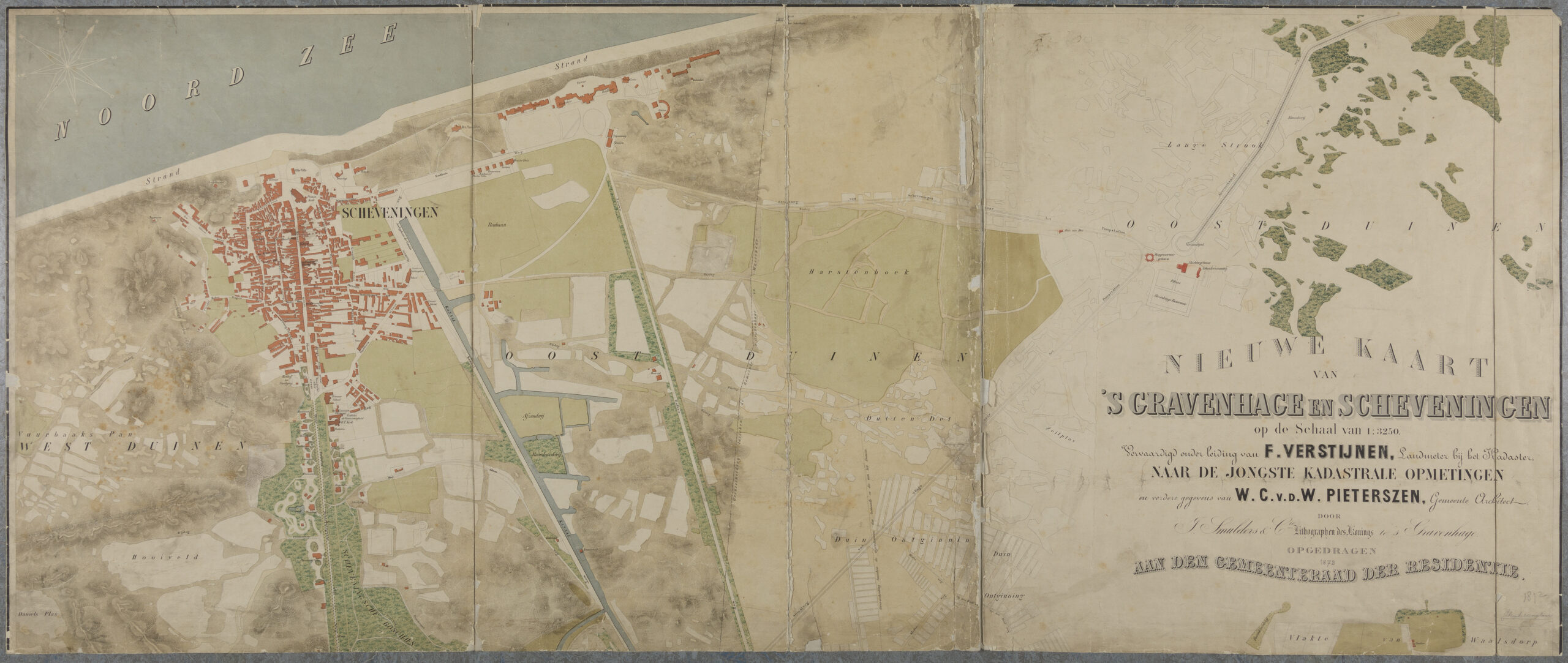
The casino is open to everyone!
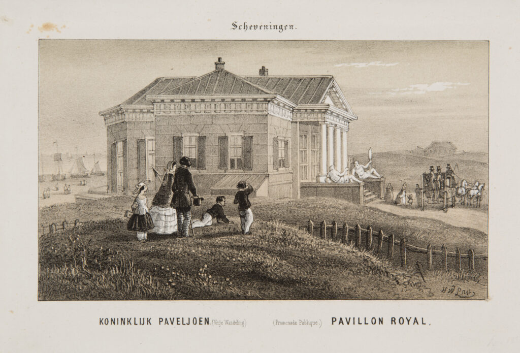
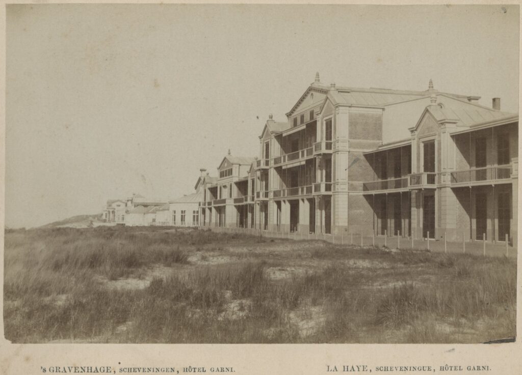
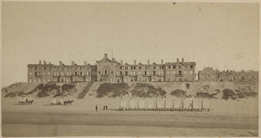
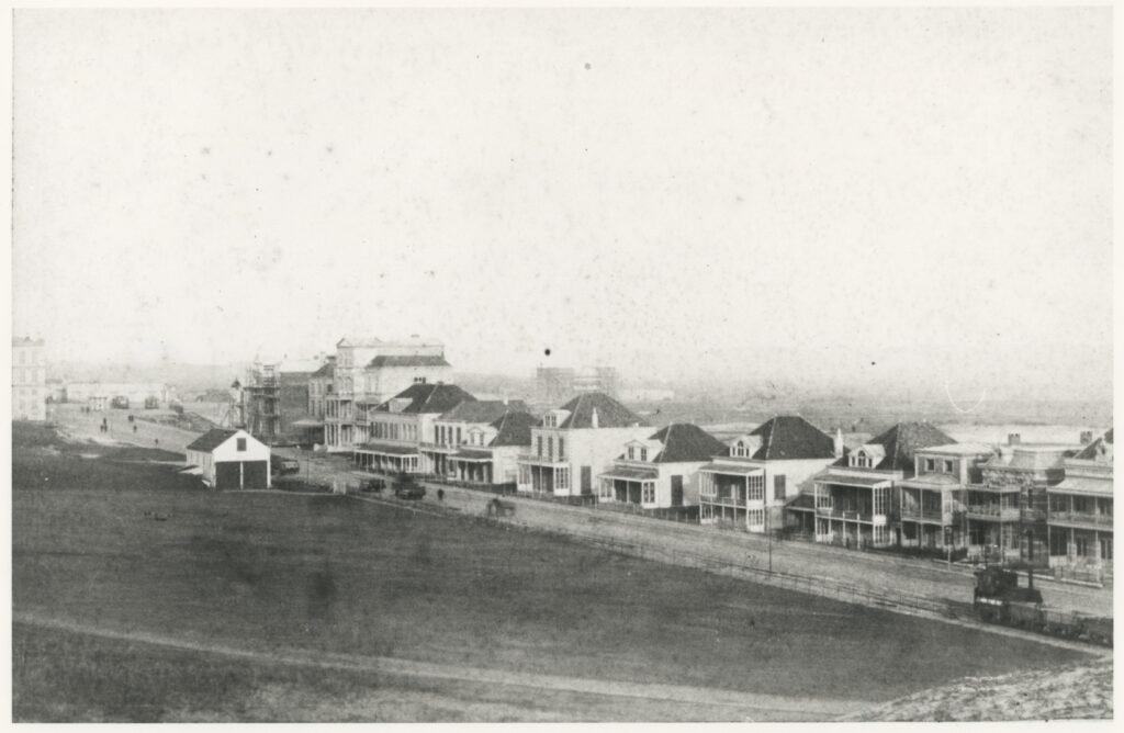
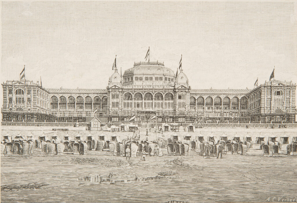
The urban ensemble of the residential parks cannot be separated from the development of the seaside resort and the possibility of a casino, the steam tram routes and the construction of the Scheveningse Bosjes (Crefcoeur, 2010). The residential parks are a less orthogonal derivative of the Willemspark. The often-asymmetrical villas of the Van Stolkpark decorated with turrets resemble in the distance the white colonial and symmetrical villas of Saraber with the verandas of the Willemspark. In the image, the seaside resort and the residential parks are therefore always mentioned together. Often these were the same financiers. The panorama painted by the banker and investor Mesdag is therefore not a disinterested representation of the grandeur of the seaside resort. The dune landscape from the fishing village to beyond the bathhouse (with all the empty building plots) was cleverly depicted in anticipation of future developments.
The opening of the casino to the general public was the beginning of the development. The international capital found The Hague and the developments in Scheveningen boomed. Especially the possibility of a casino, after 1882, was decisive for entrepreneurs from Paris and Antwerp to turn their eyes to Scheveningen. The historian Crefcoeur attributed the important success of seaside resorts such as Boulogne-sur-Mer (1765), Trouville-sur-Mer (1825), Deauville (1830), Oostende (1838) and Zandvoort aan Zee (1829) to casinos and gaming halls.
In Scheveningen this was hitherto unthinkable because these games were reserved for a class to which one could only join by strict balloting and which granted status and exclusivity to the members. Especially the conservative mayor F.G.A. Gevers Deynoot stuck to this, according to Crefcoeur. Although a request had already been made from Brussels in 1861 to rent a space for a casino and gaming room, nothing came of it. Only with the resignation of the mayor in 1882 and the arrival of the liberal successor Patijn were the chances for a casino increased. For investors from a.o. Paris, such as Goldschmidt, Coblijn, Reiss, Banque de Parijs (represented by Mr Landry of The Hague bank Gébel-Landry), Banque De Wolf and Caters from Antwerp, Scheveningen became a seaside resort of importance with the new Kurhaus as an icon. According to Crefcoeur (2010), these banks and individuals also invested in the other seaside resorts, railways and steam trams.
Already after 1864, several large and small hotels were established in the vicinity of the Municipal Bathhouse and the Royal Pavilion. Spanier’s map from 1864 (HGA kl.0463) shows only the Municipal Bathhouse, the roads and the canal. Smulders’ map from 1870 (HGA gr.0325) showed a row of small hotels and guesthouses along the Gevers Deynootweg and new large hotels next to the bathhouse on the beach. The map of Verstijnen and Van der Waeyen from 1872 also showed the row of hotels and guesthouses (Stal, Groenveld & Penning, 2007).
The most magnificent hotel was built from 1860 right next to the old Stedelijk Badhuis: Hotel Garni or Grand Hôtel Garni Château de la Mer by the Hague architect Saraber. On the other side of the Stedelijk Badhuis, three sea villas appeared after 1864: Villa Jacobson, Villa Costa and Villa Mar, an example for the new wealthy citizens of The Hague. Villa Costa was also designed by Saraber. They were white colonial-looking buildings with impressive verandas and low roof hoods that resembled Saraber’s villas in Willemspark.
The hotels and guesthouses along the Badhuisweg (perpendicular to the coastline) and the Gevers Deynootweg (parallel to the coastline) were built by private individuals in the period 1865 to 1870. They were narrow deep buildings with windows for the rooms in the side façade and with verandas across the width of the front façade, where sea breezes invigorated the guests. On the painted panorama of Mesdag from 1888, the Gevers Deynootweg with its small hotels and guesthouses was painted. Also, in 1874 the majestic and most luxurious hotel of those days, Grand Hôtel d’ Orange (1874-1952/53), was built by NV Bouwmaatschappij Scheveningen with Amsterdam capital. The original plan was to build a residential park immediately nearby, but that was abandoned under the deteriorating economic situation at the time, according to Crefcoeur. A sister company built the Amstelhotel in Amsterdam.
In 1875, Hôtel des Galeries (1875/76-1971) by architect J.J.C. de Wijs was built on the Gevers Deynootplein in strict eclecticism. This hotel was perpendicular to the coast so that the façade was facing the square and not the sea. The ensemble of hotels and pavilions was an ensemble of architecture in neoclassicism and eclecticism.
In 1882, Goldschmidt and his Sociéte des Galeries came up with a grand plan for a casino theatre for the Grand Hotel next to Hotel des Galeries on the current Gevers Deynootplein and received support from the two hotelmanagements, the Casino Committee and the Hague Business Association.
Before this plan became known, the city council had appointed a ‘Bathhouse Committee’, the Vaillant Committee, and in October 1882 it came to the conclusion that a large Kurzaal, as in other seaside resorts, was desirable. However, the dunes of Scheveningen were already completely built up. The old bathhouse would have to be demolished and replaced by a new building with more possibilities.
City architect Reinders had already outlined some proposals for the adaptation of the old building. The expansion of the City Bath House was the subject of an uproar in the City Council on November 25, 1882, because many business owners felt that the city should refrain from these initiatives, while others felt that the municipality should take up this important project, especially the conservative councilor J. J. Mock. Goldschmidt cum suis were not enamoured with the municipality’s plan to convert the Kurhaus into a casino in addition to his casino theater plan and said that he would not take any further action until a final decision was made.
Several offers were made at the old bathhouse. The Parisians Coblijn (who lived in Villa Insulinde of the architect Wesstra in the summer) and Reiss came up with the proposal to buy the old bathhouse and the opposite stables to build a Kurzaal on the site of the bathhouse and a theater on the site of the horse stables. As in other seaside resorts, the gentlemen expected an advance of 1 million, half of the construction costs for the casino, and stipulated the exclusive right to operate the sea baths, according to Crefcoeur. Goldschmidt cum suis also came up with a bid that was almost identical to that of Coblijn and Reiss and also asked for the monopoly over the electric tramway that was being considered. He was also a concessionaire of the tramway in Ostend. Van Enthoven (also commissioner of construction company Nieuw Scheveningen and family of the Hague industrialist), Ernst Preston count of Bylandt and a group of Amsterdam businessmen, supported by the Hague bank Gébel-Landry, also came up with a bid for the old bathhouse.
Tactically, the council members did not ask the council for a loan for the construction of the bathhouse and, moreover, the sea bath would not be completely closed to the public. After endless debates, on 27 February 1883 the city council approved a draft agreement with Messrs. Reiss, Coblijn, De Sonnaville and Uijttenhoven by a vote of 23 to 12. On June 7, 1883, the final contract was signed and: ‘a Parisian influence descended on Scheveningen’, according to Crefcoeur.
According to Crefcoeur, all those involved were family, personal friends or business relations of the firm Wertheim and Gompertz in Amsterdam, with the Amsterdam-Jewish Abraham Carel Wertheim (1832-1897) as the spider in the web. This family clan had commercial banks in Frankfurt, Hamburg, Hanover, Paris and Amsterdam. In The Hague, the Wertheims were already involved in the Scheveningen Construction Company and the Oranje Hotel. Wertheim was also involved in the railway line of the Nederlandsche Rhijnspoorweg Maatschappij (NRS) that connected Scheveningen with Germany. Between 1869 and 1897, Wertheim was a member and later vice-president of the supervisory board of the Company for the Operation of State Railways. He also had a major influence on the construction of the steam tram to Scheveningen. Wertheim’s relationships with Coblijn, Reiss and Ruys were particularly important in the Kurhaus plans and the development around them. Wertheim himself always continued to operate in the background, according to Crefcoeur.
On October 4, 1883, the four concessionaires Coblijn, Reiss, De Sonnaville and Uijttenhoven founded the Maatschappij Zeebad Scheveningen (M.Z.S.) in Amsterdam with capital of one million guilders mainly from Paris, Antwerp, Amsterdam, Rotterdam and a little from The Hague. It was about 1902 in the Exploitatie Maatschappij Scheveningen E.M.S. with majority interest in M.Z.S.
In addition to the ‘competitors’ Goldschmidt, Landry and Van Bylandt, almost all business relations of the firm Wertheim and Gompertz from Amsterdam were partners in the M.Z.S. Every year the municipality received the lease from the M.Z.S. and after the 1884 bathing season the old Municipal Bathhouse was demolished to make way for a spacious new building by the German architects Johann Friederich Henkenhaf and Friederich Ebert: the Kurhaus (1885/87). However, it burned down in 1886, but was immediately rebuilt and opened in 1887. One of the first sketch designs was an asymmetrical and pompous building in northern French neo-Renaissance style. In addition, the axis of the Nieuwe Badhuisweg did not connect to the building. After criticism from the municipality, the building was placed right on the axis and became a symmetrical structure. According to Crefcoeur, the construction costs did increase, because less use could be made of the old building. The spa developed into a distinguished place of health and entertainment for a privileged company.
Especially in the last half of the nineteenth century, the contrast between urban society and simple rural and fishing communities became sharper (Bank & Buuren, 2000). In any case, the privileged class could now travel pleasantly from Cologne, Rotterdam or Amsterdam to the seaside resort.
Steam tram routes to the seaside resort 1878-1886
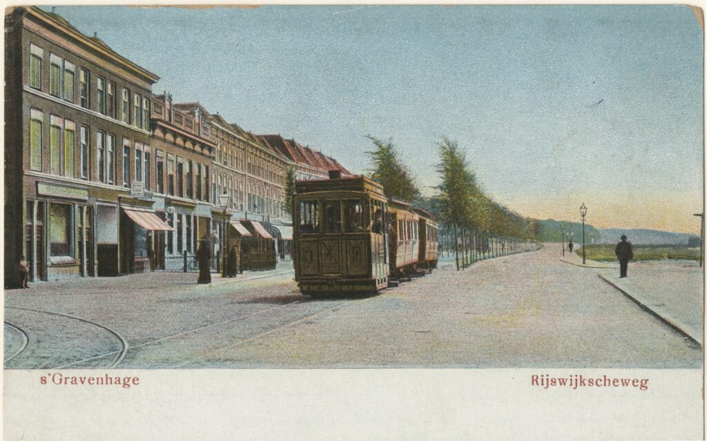
Of course, accessibility was a condition. Hollands Spoor station had already been built in 1847. In the year 1870 the Station Rhijnspoor (later called Staatsspoor and later Central Station) was built by The Nederlandsche Rhijnspoorweg Maatschappij N.R.S. The Hague was now connected to a rail network that extended into Germany (Bock R. , 1975). Here, too, the big man behind the scenes was the Amsterdam banker Wertheim. There was already a network of horse-powered tramways that stretched from the seaside resort to other cities. The first concession of horse-powered tramways was from 1863 (Bock & Klomp, 1975).
At the same time as this stormy development in the seaside resort with the new built hotels, a network of steam-powered tramway routes was built between the seaside resort, the Westland and the train stations between 1878 and 1887. The steam-powered tramway was similar to the Stadtbahn that were built in the German cities. A steam-powered tramway was a small train that was much faster and stronger than the horse tram. He could transport people to the seaside resort and transport goods from the Westland to the station.
In December 1878, a concession was granted to build the first power tram from Rhijnspoor Station to the Kurhaus, according to De Bock. This first steam tram in the Netherlands was opened on 1 July 1879 and ran over the Koningskade, Raamweg and Badhuisweg to the Stedelijke Badhuis. There was even a ‘stock exchange tram’ that left Scheveningen every morning at 7.37 am and arrived at Rotterdam Beurs Station at 8.38 am. The second steam tram line, the Westland line, which was opened on 24 June 1882, reconnected to lines at Hoek van Holland and Maassluis. Especially for goods, this line had a special significance: all Westland auctions were connected to this line and fresh vegetables could be transported quickly from the horticultural areas to the cities. This line ran via the Loosduinsekade. The third steam tram line was the Voorburg line, which was opened on 19 June 1885. The tram line from Leiden to Voorburg was then connected to The Hague.
The fourth steam tram line was that from Hollands Spoor Station to Scheveningen via the west side of the city. A concession was granted on 20 May 1884 and three lines were opened on this route on 12 June 1886. Hollands Spoor – Scheveningen village, Hollands Spoor – Anna Paulowna, Anna Paulowna – Scheveningen village. The route ran via the Parallelweg and the Gasfabriek to the Conradkade. At the Laan van Meeerdervoort there was the fork that ran parallel to the Laan van Meerdervoort to a station at the Peace Palace. From there the route went via the Verversingskanaal and with a large curvature via the Van Boetzelaerlaan to Scheveningen village. A connection was made at the junction of the Westland line and this fourth steam tram line, so that goods from the Westland could be transported directly via the Hollands Spoor to other cities.
In 1887, the Huygensplein-Delft line was replaced by the much faster fifth steam tram line. The city map of Lobatto from 1891 (HGA gr.0352) showed that the entire area of The Hague had already been crossed with canals and steam tram routes.
City architect Lindo would further expand the electrification of the tram network in the fin de siècle, especially for this he hired civil engineer Piet Bakker Schut. In 1904 and 1905 the two lines to Scheveningen were electrified and given overhead lines. By the First World War, an electrified tram network stretched that connected the seaside resort, the residential areas, the Westland, the old town, the neighboring towns and the two stations. From 1908 to the fifties there was even a direct train connection from the Kurhaus to the Hofplein in Rotterdam via the Hofplein line. Scheveningen Bad was a chicken with golden eggs for investors. However, it didn’t stop there. All these new connections made the residential parks an attractive place for wealthy citizens to live.
The belt of emerald: the ring of residential parks around the Scheveningse Bosjes
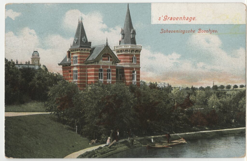
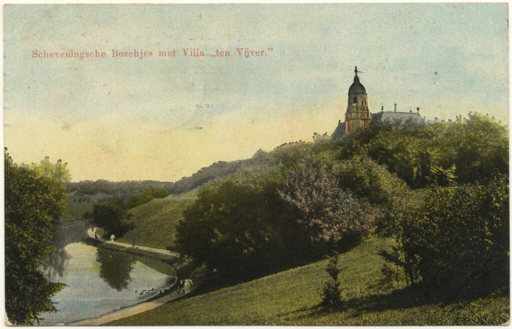
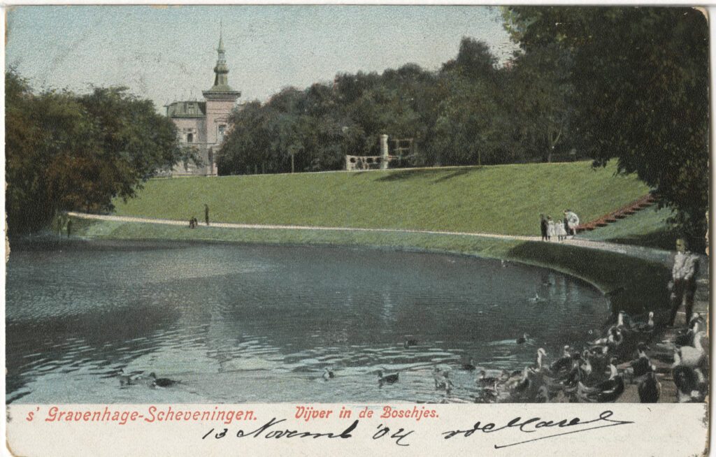
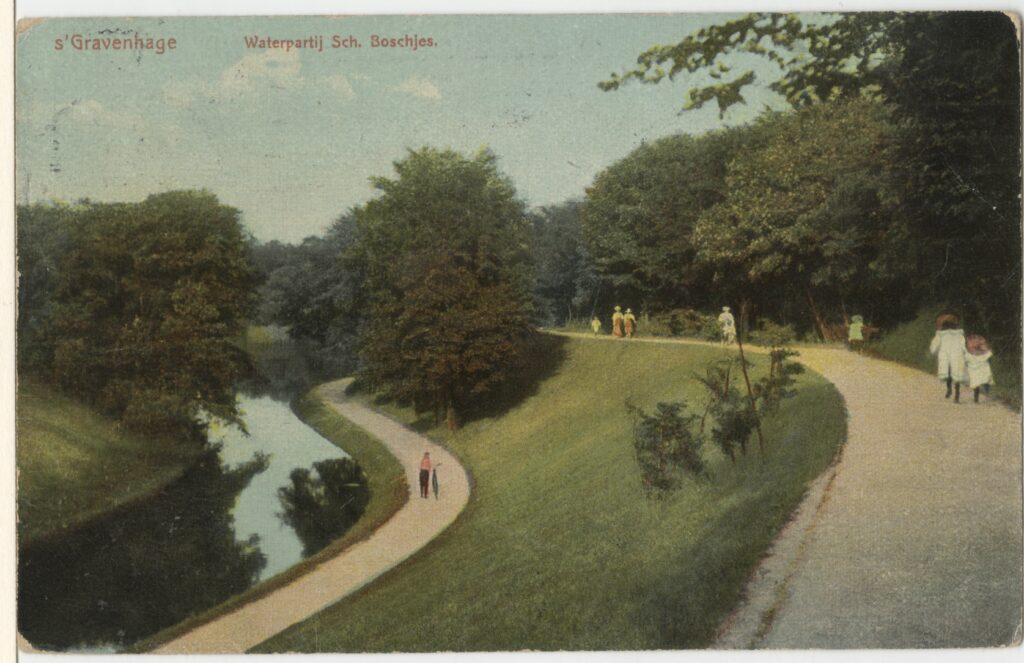
The belt of emerald refers to the green islands of the former colony of the Netherlands, present-day Indonesia. In The Hague it was also used to indicate the ring of luxury residential parks around the Scheveningse Bosjes. As with other seaside resorts, there was a demand for country houses in the vicinity. Social life took place here for tired German and Rotterdam businessmen on weekends and holidays. Here one could stroll, dine, do business and enjoy the music that was played in the evening (Crefoeur, 2010).
Despite the policy of government abstention, the municipality laid the foundation for an attractive living environment behind the dunes of Scheveningen. In 1868, on the initiative of alderman H.C.A. Ver Huell, the municipality transformed the canals of the sanding plant into a number of graceful water features surrounded by a park-like landscape (Koopmans, 1994; Landheer-Roelants, 1999; Koopmans & Valentijn, 2000).
For the design of these Scheveningse Bosjes, the alderman attracted J.D. Zocher Jr. and his son L.P. Zocher. The Zochers were also busy with the neighboring residential park of the Rotterdam businessman and lawyer Mr. Thomas van Stolk. Between 1872 and 1873 he had bought a large piece of sanded dune land for a residential park (Landheer-Roelants, 1999). The villapark and the municipal layout of the sanding plant were thus designed by one party. The Zochers created a landscape ensemble with villas and water features: the Scheveningen Park. Construction began around 1874 and the water features were completed in 1882 (HGA z.gr.1343 & kl.1545).
Characteristic of the residential parks in The Hague would be the special street plan, which was reminiscent of a village with summer villas, hotels and guesthouses along it. The round-point with a monumental work of art was also not missing in the residential parks. There was a middle section surrounded by a ring road. In the middle could be a monument, an important house or just a number of houses. From this ring, the connections were made with the existing urban fabric or landscape. Of course, these ornate English-inspired residential parks were not as stiff as the Willemspark.
When building the villas in the new residential parks, they did not skimp on the construction costs or the facilities. They worked generously in different architectural styles. However, one type of villa was particularly popular in the early days. Saraber’s villas in Willemspark were the model for this: a villa in colonial eclecticism with wide verandas and balconies and in the foreground a green lawn overlooking the Noordsingel.
Villas that Zocher drew in a residential park study from 1852 also reminded of this. Similar villas were built next to the Municipal Bathhouse after 1864. These three villas that were wedged for years between the Kurhaus and the Oranje Hotel certainly contributed to the popularization of this type. The villas in the Van Stolkpark were located in spacious gardens and the roads, with a curved course, were richly decorated with trees, so that there was a beautiful interplay between the green and white of the villas. From 1875, the first white villas with verandas and spacious balconies were built along the Van Stolkweg. For example Villa Louise (ca. 1879), Villa Emma (1885/86), Villa Germania (1882/83), Villa Margaretha (1881/82) (Rosenberg, Vaillant, & Valentijn, 1988). Shortly after the construction of the Van Stolkpark, hotels were also established here, such as the white-plastered Bella Vista (Van Stolkweg 16) with its balcony and verandas and the enormous Parkhotel (Parkweg 13) in brick. With the construction of the Belvedereweg in 1900, the villa park was completed.
More to the sea and the Kurhaus was the Belgian Park (Crefcoeur & Van Pesch, 2009). The main contractor of the Kurhaus, the company Fernim, was also involved in the construction of the Belgian Park (Crefcoeur, 2010). The construction of the Kurhaus and the Belgian Park was in the same period and the contractor used his people and equipment for both projects. Should work on the Kurhaus come to a standstill or planning technically falter, construction workers could immediately continue with the villa construction. The construction management and operation of the villapark came into the hands of the ‘Hollandsch-Belgische Bouwgrond Maatschappij’ of Janse Johzn, who was familiar with the contractors of the Kurhaus Fernim and Gips.
The atmosphere here was different from that in the Van Stolkpark: there was a seaside resort bustle and the buildings were contiguous in many places. The Belgian Park, initially called ‘Nederlandsch-Belgisch Park’, was commissioned by E. Cambier, director of the Societé Anonyme des Tramways de La Haye. The landscape architect T. Coppieters drew the urban plan, although according to Crefcoeur his contribution should be considered minimal. The oldest part was formed by the Belgian Square, a very spacious roundabout with trees and grass, adjacent to streets with trees and a winding course. Spacious front gardens and villas with generous balconies and verandas lined this square, such as the colonial-looking houses at Belgischplein 31-34 by Coppieters from 1886. At the end of 1883, the first pavement in the Belgian Park was laid and the first villas were built: Villa Victorine, Villa Elise and Villa Jean-Antoine, with onion tower (1883, Coppieters, Luiksestraat 2 and Antwerpsestraat 1). Villa Jean-Antoine built contractor Fernim for himself and he named it after the founder of the construction company. In villa Elise, Janse Johzn and Enthoven established their own insurance company with the Kurhaus fire insurance as one of the policies according to Crefcoeur. The construction management for the Belgian Park consisted of Janse Johzn, Fermin, Gips and the Scheveningen contractor and supervisor C.G. Pauptit. Not long after, the construction management for the Kurhaus was formed by almost the same people: Reiss, Janse Johzn, Fernim and Pauptit.
The seaside resort, the residential parks and the direct steam tram connection to the train stations and the fast connection to Germany made this urban ensemble successful. The villas and parks that merged into each other formed one green zone around the Scheveningse Bosjes and gave it a unique character and the nickname ’the belt of emerald’.
Cases of the citizens' quarters
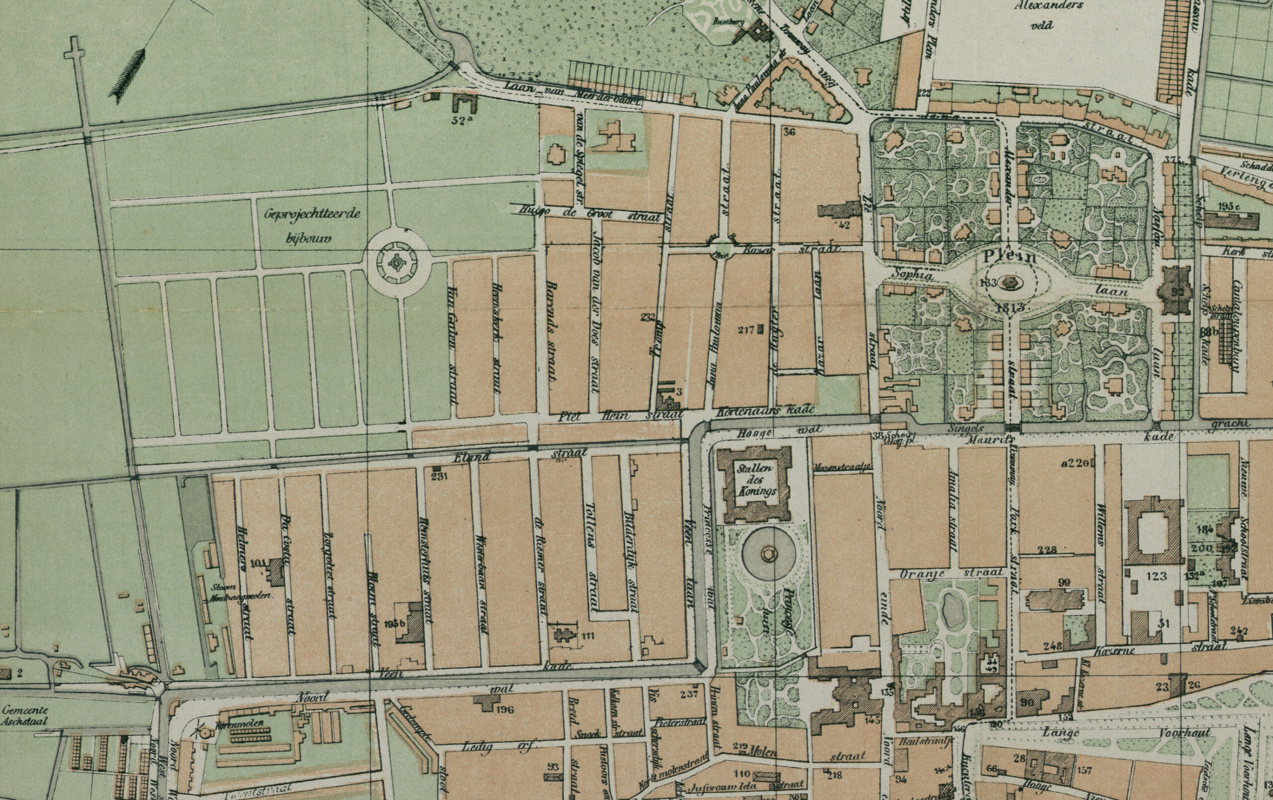
Beautification as a utility?
The expropriation question was central to the layout of the civilian quarters. In order to expropriate, there had to be a benefit for the society, according the government and the liberals of Thorbecke. However, the municipality of The Hague with conservative administrators felt that beautification was also benefits the society. However, the government stood its ground with this conflict with the municipality.
The civic quarters such as the Zeeheldenkwartier and the Archipelbuurt were built between 1865 and 1890 by public limited companies. They are characterized by poor grid street plans with half-completed ronds-points and a somewhat monotonous in architecture and chaotic location of the buildings and streets because existing buildings could not be expropriated, especially the Zeeheldenkwartier shows this while the Archipelbuurt already had more structure. A city image and neighborhoods copied from the major metropolises were finally half-heartedly explained in The Hague. In the wider streets, 14 meters, which led to the ronds-points, shopping facilities arose. The stony residential streets with a width of 10 to 12 meters had no front gardens or sidewalks, often there were also shops, businesses and facilities such as schools. The difference with the working-class neighborhoods was that in the civilian neighborhoods there were rounds-points and more wide streets of 14 meters, so that there were urban spaces for the more expensive houses. Furthermore, there were considerably fewer upper and lower houses and sometimes courtyard houses were prohibited. Houses are better built and more spacious. Well-known ronds-points in The Hague are: Anna Paulownaplein, Prins Hendrikplein, Bankaplein and Koningsplein. The last square was inspired by the English squeare, a spacious square square with a public park in the middle (Olsen, 1986) (HGA 0.38921). These squares lay like beads on a chain, punctuated by flawed private street plans. As with the Plein 1813, these squares ideally housed four stately detached houses, the largest and most expensive of the quarter. However, virtually nothing came of this ambition and often a few years later the square wall was restored to get closedness in the image. That is why the buildings were placed random around the ronds-points (HGA 5.15742 & 0.07838).
After 1875, the municipality started to set conditions from the police ordinance, which were also included in council reports (Algemeene Politieverordening voor ’s Gravenhage 19 september 1871 en 20 juni 1876). When street plans were presented to the council by the ‘Council Committee on Local Works and Property’, also known as the ‘Commission of Manufacture’ or simply ‘Commission’, this was the assessment framework for construction plans. This Commission first had to approve the building plans of entrepreneurs. The houses ranged from distinguished bourgeois houses in the tradition of Delia on the wide streets and squares to simple small houses in the back streets and in courtyards. The beautiful plaster on the façade was reduced to a minimum here. The inhabitants of these new neighborhoods were mainly returnees from the colonies, civil servants, officers and non-commissioned officers, or the middle-class who moved away from the inner city.
Avenue Parkstraat and the neighborhood of Delia
Pieces The Hague were connected by entrepreneurs such as Delia. Avenue Parkstraat played an important role in this. After the success of the Willemspark and the buildings along the Mauritskade and the Javastraat, on 27 March 1866, during the city council meeting, the ‘Committee of management of the estate of H.M. King Willem de IIde’ announced to sell the then rented garden of Kneuterdijk as building land. It was the site that is now bordered by Parkstraat, Mauritskade and Oranjestraat. The Amaliastraat formed the center of this neighborhood. The palace on the Kneuterdijk was at that time inhabited by King Willem III. This urban ensemble is important because with this district separate parts of the city were connected by the new Parkstraat. An important connection from the old center of power on the Lange Voorhout to the new center of power the Willemspark.
The committee, the municipal architect Van der Waeyen Pieterszen and the municipal executive had already discussed this garden, but now the committee had the conditions attached to the sale ready. The condition of the commission to the buyer was that two streets should be left undeveloped and that they should be transferred freely and unencumbered to the Municipality. These were the streets that were later called the Amaliastraat and the Oranjestraat. During the city council meeting, the municipality made a commitment that it would pay for the pavement, gas lighting and sewers in the streets. Conditions were also set by the committee for the buildings. No buildings were to be erected ‘serving for hospital, spiritual or charitable asylums, almshouses, theatres or local for public entertainment, factory or workshops with or without steam tools, bleaching, butchery, shops selling meat, bacon or game, together with stables or carriage houses, in so far as the latter are visible from the street.’
Het Stedelijk Keur from the period 1841-1892 left a free hand in courtyards to entrepeneurs and speculators, while on the street the facades were not allowed to mar the city. However, in this prominent neighborhood of Delia, construction on courtyards was also reduced. Furthermore, the committee stated during the meeting that the width of the streets should be at least 16 meter and provided with two sidewalks. It was also stated that there should be middle-sized mansions that were in no case less than two stories high and at least 12 meter high to the ‘placier list’. Houses with colonnades or passages were also allowed to be built. Furthermore, the requirement was: ‘The houses, to be built along the Parkstraat and the Mauritskade, will have to be at least of the same size as the houses currently present on the Mauritskade, calculated from the Parkstraat.’ The committee set the previously built chic mansions of the architect Delia on the Mauritskade as an example for the buyer of the building land. The proposal of the committee and the municipality was adopted unanimously (24) votes in the council meeting. In a missive of the committee of April 24, 1866, a number of minor additions were made. During the city council meeting, there was a reaction to the missive that could be misinterpreted. Councillors at the meeting of May 1, 1866, found that the buyer of the building plots should cede the land to the municipality without restriction.
Delia made an offer in 1867, but the municipality had apparently regretted the original asking price of 1 Dutch gulden per square meter of building land. The municipality now believed that the price for the land should be the same as for the land that Delia had bought for the houses on the west side of the Parkstraat, which was already owned by Delia. Delia sent a letter to the council objecting to this new price for the building land. From the letter that was discussed during the meeting of 7 May 1867, it was clear that the plans that Delia and his employees drew at the end of 1866 for the Parkstraat and the Mauritskade (between Parkstraat and old buildings of the Scheveningse Veer near the Noordeinde) had to be seen in conjunction with the plans for the two new streets (Amaliastraat and Oranjestraat), but especially with the axis from the Lange Voorhout to the Willemspark. Delia’s proposal was that he would sell a piece of land on the Parkstraat back to the municipality so that the Parkstraat could be widened and ’to make that street more associated with the Willemspark and thus to create a substantial embellishment of that entire quarter’s when a better entrance to the Voorhout side could be obtained in the future.’
With his proposals, Delia emphasized the general interest for the municipality and the improvement of the situation in The Hague. Delia’s letter showed that the council members thought it was a good idea, but that they still had difficulty with a land price of perhaps 8 Dutch gulden per square meter. Delia had applied for a measurement for the houses along the Parkstraat and Mauritskade (between Parkstraat and Scheveningse Veer) and wanted to achieve a favorable exchange of land and low land price, for the benefit of everyone. A week later, the council deliberated on May 14 on the proposed land transaction and land price by Delia. The municipal executive, but also council members such as Bervoets, could not agree with Delia’s proposals.
At the city council meeting on May 4, 1869, Alderman Verhuëll informed the council that they were out and that the Committee of Manufacture considered Delia’s proposals and calculations plausible. Councilman De la Bassecour Caan reminded the city’s administration that Delia had bought the garden to cultivate. Delia then turned to the municipality with the request to buy the land along the Parkstraat at a later stage for its widening. In the end, Delia bought that land in the interest of the municipality, according to the council member, an offer from Delia that had been favorably received by the municipality at the time. After a vote on the transaction, the city council meeting on May 14 came up with 16 for and 16 against, which meant the matter was pushed forward.
At the council meeting of November 2, 1869, new arguments were made in favor of widening the Parkstraat and the Kloosterkerkstraat. The ministry that was located on the corner made demands on the tramway that moved through the narrow street but also on the carriages through the street. Mr Mock spoke in the council chamber about an ‘avenue’:
‘And now I could accept the prae advice and allow the whole 84,000 guilders, if by the proposed relocation of the Kloosterkerkstraat a beautiful whole was placed there, an avenue in whose middle one could see the monument of 1813 at the end.’ (City Council meeting, November 2, 1869: 238)
Also interesting are the concepts anf words used in the council documents when explaining neighborhoods and referring to the countries of origin such as: ‘rond-point’, ’tramway’, ‘avenue’ etc. The influence of metropolises such as Paris and London must have been great in The Hague. Mr. De Pinto did not see the importance of the ‘avenue’ and the ’tramway’ for the city. However, the road to Scheveningen would no longer lead via the narrow Noordeinde in the future, the chairman argued, but via the new spacious road of the Parkstraat and the Willemspark. The old proposal to widen the Lange Poten and the Veenestraat was also discussed. The chairman sighed at the council meeting of 2 November 1869 that: ‘For eighteen years we have been discussing the reclamation of the Veenestraat and it is not there yet. And as for the Legs, I feel that our grandchildren may not experience the breeding of them once.’ A motion to postpone the decision was not passed and finally the council passed a motion to widen the Kloosterkerkstraat. Gentlemen such as De Pinto, Mock and industrialist Van Enthoven voted against this excess of an ‘avenue’ ordered by the municipal treasury.
At the city council meeting of November 30, 1869, the negotiations between Delia and the municipality were so far that the municipal executive could offer the council a proposal on the widening of the Parkstraat, the land price and the exchange transaction. Finally, towards the end of the year, the municipality and Delia reached an agreement on the land transaction that made the widening of the Parkstraat possible.
Around 1869 the construction of the Oranjestraat with buildings from ca.1875 and the Amaliastraat with buildings from 1868 or 69 followed. In 1882 the municipality bought the remaining part of the garden of Kneuterdijk and built the Paleisstraat there. Between ca. 1883-90 the last buildings were built here (Rosenberg, Vaillant, & Valentijn, 1988).
A large part of the buildings from the period 1860-1890 in the Willemspark (Alexanderstraat, Plein 1813, Javastraat) and from the Mauritskade to the palace cluster (Amaliastraat, Oranjestraat, Parkstraat) were designed by the architect and entrepreneur Delia. These buildings have a great architectural and typological similarity. There was a low basement (also called mezzanino or mezzanine) with the entrance and the kitchen where the staff stayed. The façade was made of bluestone or had checkered plaster with small square windows. Then a high first floor where the lord and lady of the house stayed and dined with a sleeping floor above. Both floors had high windows with a white frame in a brick façade. The first floor often also had a representative balcony on the street side. On the top floor (sometimes also called mezzanino or mezzanine) the staff and often the children slept. This had a low plastered façade with small horizontal windows with consoles between them on which the gutter rested. There was a large overhanging cornice and above it a zinc roof with a slight slope. The status of the different rooms could be read per floor by the façade materials and the height of the floor. A block of Delia’s mansions often had a risalite at the ends and/or in the middle, a staggered forward in the façade, which makes the row of mansions a whole, just as Van der Waeyen Pieterszen had drawn for the Javastraat in 1862.
Delia’s blocks of mansions were imitated in civilian districts such as the Archipelbuurt and the Zeeheldenkwartier, often in a simple and affordable version.
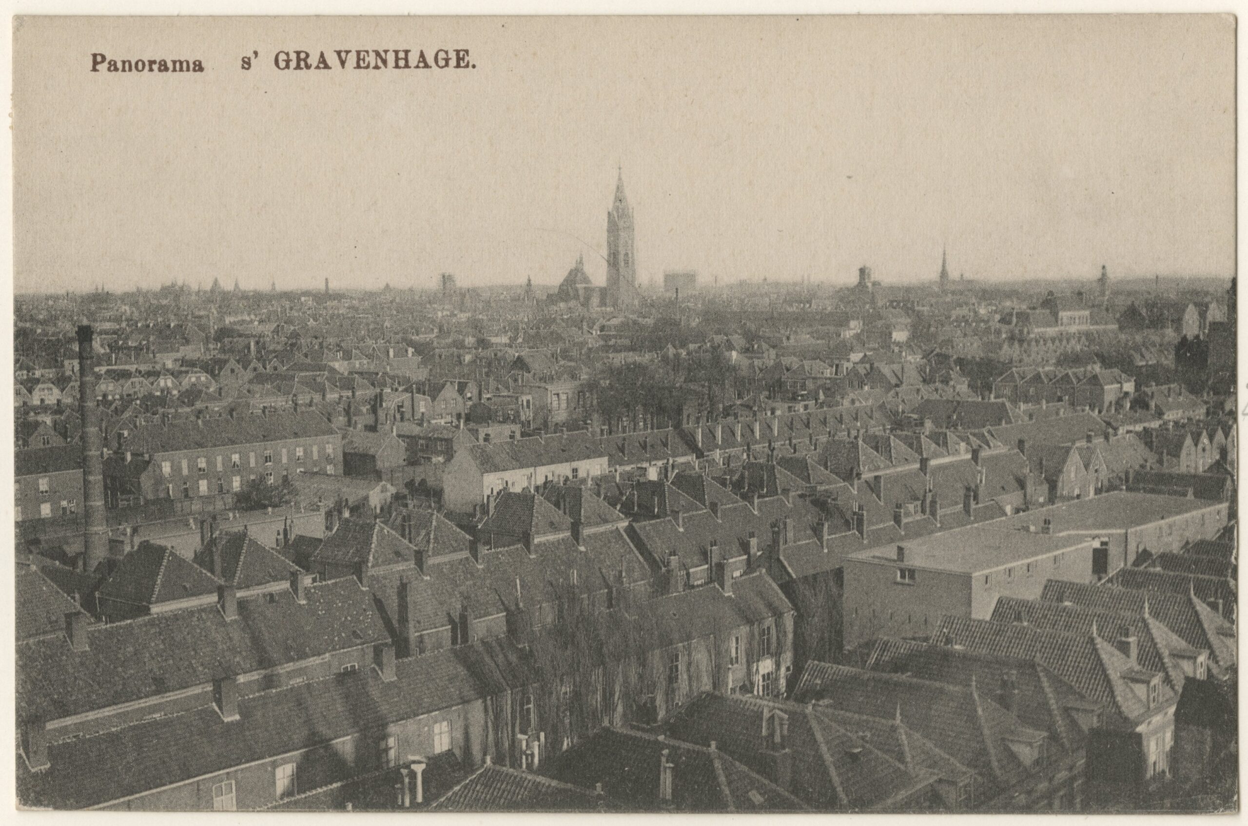
Zeeheldenkwartier: beautification is not a public utility
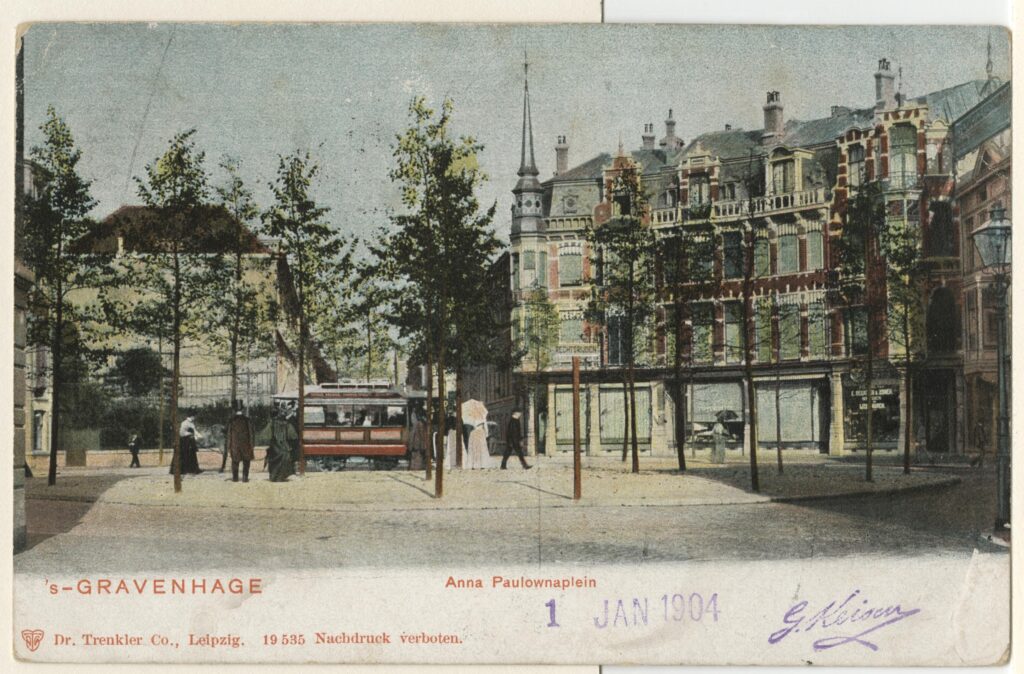
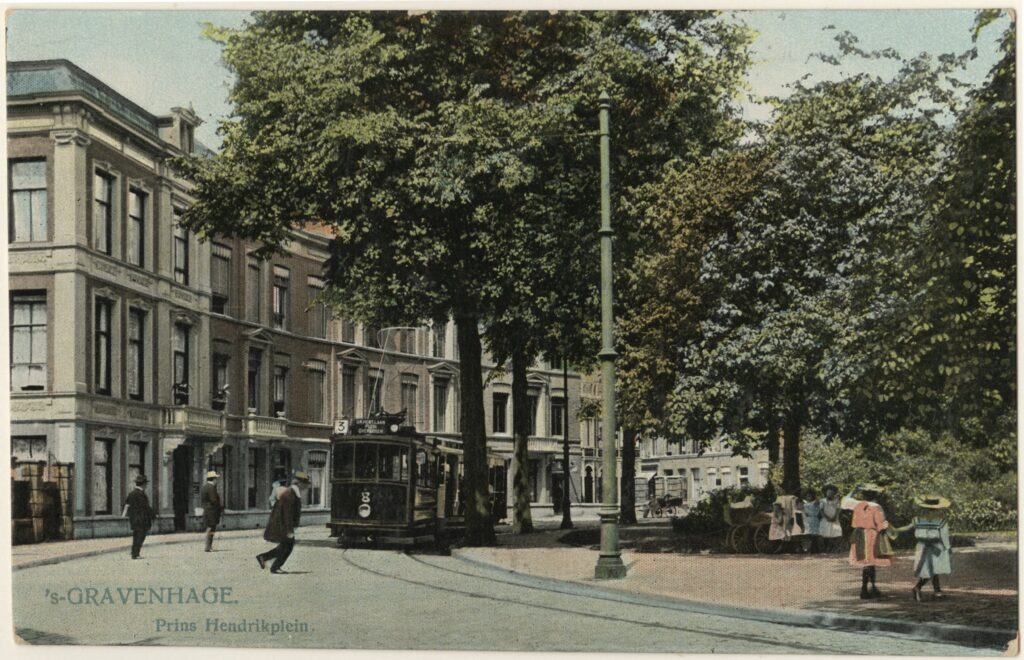
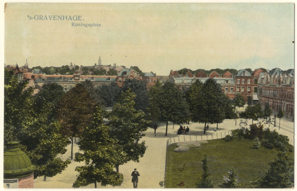
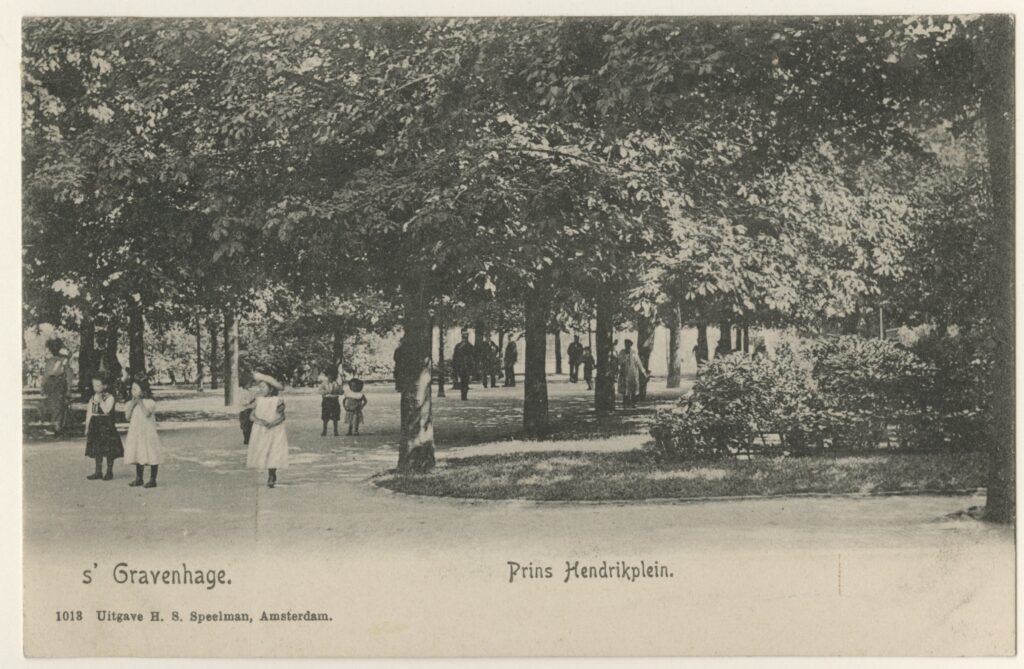
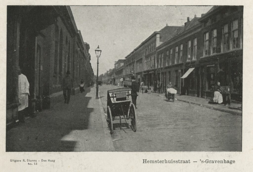
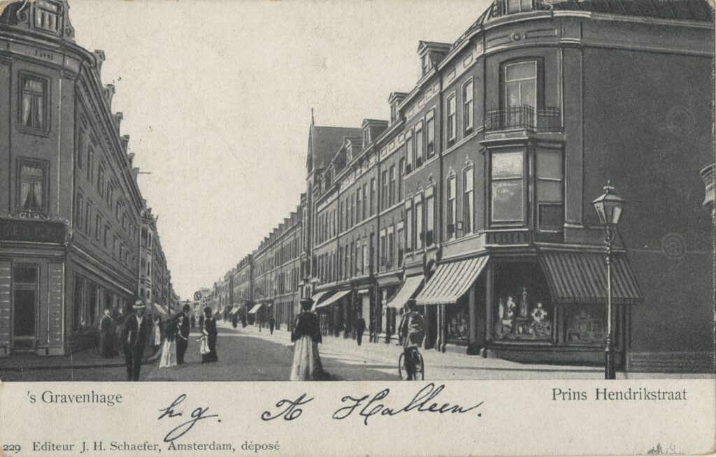
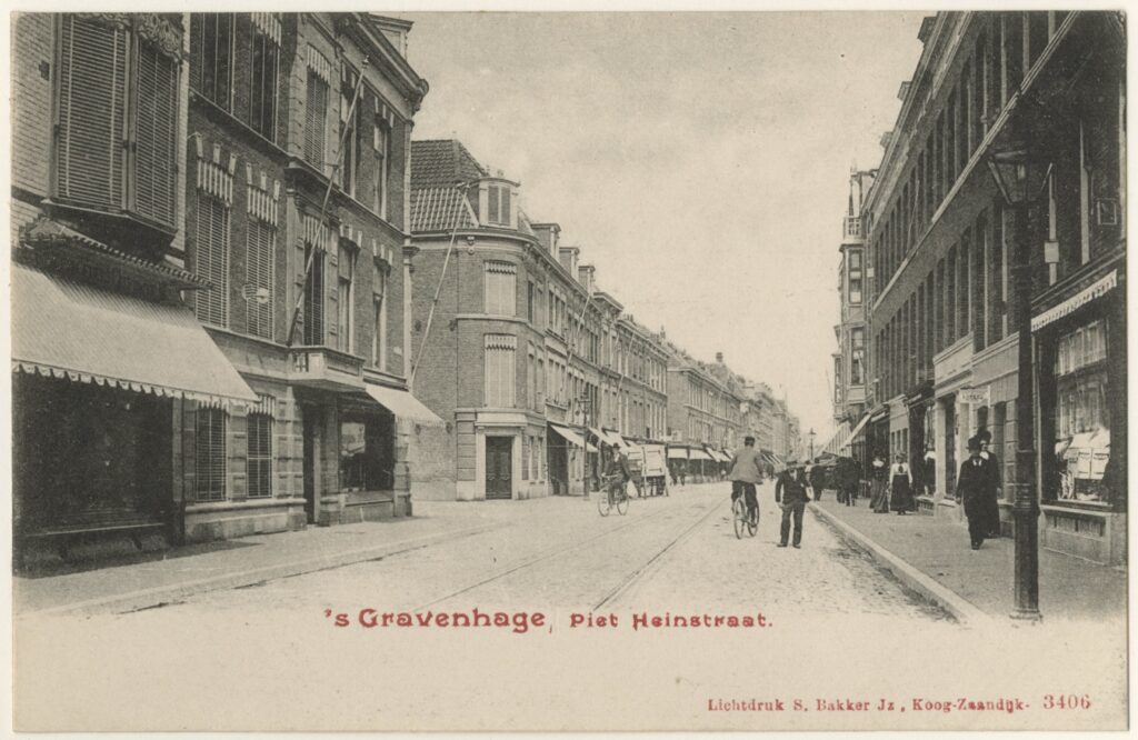
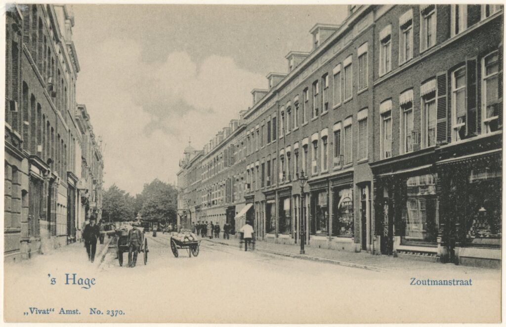
The layout of the Anna Paulownapark (currently the aeria Anna Paulownaplein en -straat, Trompstraat, De Ruyterstraat en Bazarstraat in the Zeeheldenkwartier) in the Kleine Veentje is exceptionally well documented in the council acts due to the high-level conflict about the usefulness of beautification between conservatives and liberals. During a meeting of the city council on November 15, 1859, the municipality already unveiled the plan to build a second residential park in the Kleine Veentje that connected to the Willemspark. Two new important streets were planned: the extension of the Sophialaan and the extension of the Prinsessewal to the Laan van Meerdervoort, two through streets and monumental axes that crossed each other at right angles at the level of the current Anna Paulownaplein. Especially for this purpose, they wanted to build a new bridge over the Noordsingel to be able to extend the Prinsessewal. The Prinsessewal could thus be extended straight to the Strandweg (later called Scheveningseweg) past the Buiten Rust palace and to Scheveningen village. The Prinsessewal was also extended into the Prinsessestraat, which partly also became a breakthrough to the Kerkplein and the old chruch, where a few years later the buildings around the Jacobskerk with new facades of Saraber were removed, so that the monumentality of the church was increased. In this period, one of the most monumental and largest public buildings in the city, the Main Post Office (1886/88-1964) was also built on Kerkplein and Prinsessestraat by the Cuypers supporter Peters. This would create a continuum of monumental urban spaces and connect the old city with the new residential park and Scheveningen village, an ambitious plan by Van der Waeyen Pieterszen. The majority of the committee was of the opinion that implementation could only take place if a ‘General Plan of Development of the Municipality’ had been laid down, as described in a report on 9 August of that year. For the council at the city council meeting of November 15, 1859, this proposal was a guideline for the later expansion and the committee received much support from the council members in these proposals to beautify the city. In order to realize this plan, housing had to be expropriated. Tempers ran high in The Hague council about this. At the Veenkade and in the Zeestraat, the town halls wanted to expropriate and demolish in order to be able to extend the important thoroughfares. But just like in the Schilderswijk, the edges on the outside of the canals were already built or people were busy building houses, such as on the Toussaintkade (then called Veenlaan) and after 1860 also on the Veenkade (before 1869 called Buitencingel). A good connection to the city was so difficult to make, especially since property was scattered and ‘beautification was not a public utility’ according to liberals, so no argument for expropriation and demolition of existing houses. In 1865, the Hague architect S.J. de Vletter (1823-1872) submitted a private street plan on behalf of a company, which worried a number of council members. The Anna Paulownapark had to continue the grandeur of the Willemspark in the Kleine Veentje (Zeeheldenkwartier). At a session of the city council on December 27, 1865, Mr. Quarles of Ufford observed that the municipality had been presented with a fait accompli by De Vletter cum suis. The land for which the Commission of Manufacture had such fine ideas in 1859 turned out to be sold privately to a building-land-company. Of this sold building plot, building plots had also been resold to 15 people, which made the city expansion there impossible. All costs for paving, lighting and sewers were shifted to the municipality by De Vletter. A widening of the street from the Prinsessewal to the Scheveningseweg was not taken by De Vletter. The entrances to the new district were also not foreseen as the committee had thought: ‘They too would have liked to see these accesses, convinced that they would be very much aimed at embellishing the entire plan and, above all, making a beautifull whole with the Willemspark.’ However, for the connection with the Willemspark, 3 to 4 houses on the Zeestraat had to be expropriated and demolished in order to be able to extend the Sophialaan. That was a cost that the committee could not justify. The access to the Prinsessewal was also a problem because it required land from Mr Smeele’s bleaching plant. It was uncertain whether Smeele wanted to cooperate with De Vletter’s plan. Only the third access, from the laan van Meerdervoort was assured. The chairman pointed out on the councel meeting that an earlier plan by De Vletter in 1859 was supported and in line with the ideas of the committee. The big question was rather: who bears the costs for the expropriation for the entrances to the district at Sophialaan and Prinsessewal? According to the chairman, these costs could in any case not be borne by the city, because the expropriation law did not allow this: ‘because the Minister would say very bluntly: this extension does serve to beautify, but is not in the interest of the public benefit of the city.’ De Vletter offered to contribute 30,000 Dutch gulden to the expropriation if the land of the bleaching plant was transferred to him. However, streets could be expropriated, but the land next to the streets could not be expropriated. This remained in the hands of the bleaching plant. Councilor Stam argued at the council meeting of 27 December 1865 that: ‘for The Hague beautification is of public benefit.’ The chairman reminded Councilor Stam that the minister did not see embellishment as a public issue in other expropriations in The Hague and that the minister and the city council differed in this respect. Eventually, the council decided to continue negotiations with De Vletter and the Manufacturing Committee was asked to draw up a General Plan for the Kleine Veentje.
In 1866, Van der Waeyen Pieterszen came up with a Plan voor Uitbreiding van het N.W. Gedeelte van ’s Gravenhage where a diagonal street had been drawn by the Kleine Veentje, which ran from a newly planned station to the Laan van Meerdervoort, with two ronds-points, one as a center for the district and one on the Laan van Meerdervoort. The Noordsingel and the canal at the Prinsessewal were dampened in this vision of Van der Waeyen Pieterszen. Three street plans that were discussed with building-land-companies were drawn in it. During the council’s deliberations on 2 February 1866 on De Vletter’s plan, it appeared that he wanted to keep the roundabout in the centre of his own neighborhood, while Van der Waeyen Pieterszen wanted it on the Laan van Meerdervoort. The streets of De Vletter have a width of 10 el (one el is since 1820 one meter) while the main street was 14 to 16 el (metres), the council members noted from the drawing. Finally, at a meeting on February 20, 1866, the council adhered to the Plan voor Uitbreiding van het N.W. Gedeelte van ’s Gravenhage from 1866 with the round-point on the Laan van Meerdervoort, but proposed to negotiate with De Vletter about the direction and width of the streets. The connections with the city were seen as essential but problematic, given the scattered ownership relationships and the lack of opportunities for expropriation.
Entrepeneurs built in the polders faster than the Manufacturing Commission could think and draw. An unworkable situation arose. De Vletter would simply carry out its original plan without taking the environment into account. The Anna Paulownastraat would never become the wide through street from the Prinsessewal to Scheveningen and the Sophialaan would never be extended to the new ronds-points in the Kleine Veentje. After endless deliberation, the council overwhelmingly concluded that Van der Waeyen Pieterszen’s plan from 1866 had to be implemented, but De Vletter had already sold the land needed for this to builders, so that the round-point on the Laan van Meerdervoort could no longer be carried out. At a municipal council meeting on 9 October 1867, the Grand Duchess also spoke out against the idea of a round-point at the door of her Rustenburg palace. The Anna Paulownapark eventually became not a second Willemspark with wide streets that connected to the surroundings, but a flawed grid plan with too narrow streets and too high buildings and two ronds-points that were not connected to each other.
The Dichtersbuurt between the Elandstraat and Veenkade also followed that fate. On August 14, 1873, a partnership with Maxwils, De Sonnaville and Post submitted a plan to build the Riemerstraat and Westerbaenstraat. The streets started at the Veenkade and ended at a canal (nowadays the Elandstraat). The partnership’s proposal was that the municipality pay for the pavement and a bridge over this canal. After all, that made the explanation of a street on the other side of the canal possible and was in the interest of the municipality. On May 4, 1875, the board informed the council that street plans by M. ten Kate cum suis and G.J.M. van der Kroft cum suis had been retained. These were the streets between the Laan van Meerdervoort, Trompstraat and Piet Heinstraat, presumably the Van de Spiegelstraat, Jacob van de Doesstraat and Hugo de Grootstraat. The streets were given a width of at least 12 meters with a height of up to 12 meters. The corner blocks had to be rounded with a radius of 5 meters, considerably wider than the police ordinance stated. No provisions have yet been included about indoor and outdoor sewers, lighting and conditions for the purchase of the street by the municipality. During a council meeting on September 12, 1876, the street plan of De Lint in the Dichtersbuurt was discussed. It was the Bilderdijkstraat and Tollensstraat. The Veenkade had been built on a few years earlier and negotiations between the owners and De Lint about demolition was ended. It was impossible to connect the Tollensstraat to the Veenkade. There was a commotion in the council about this and council member Mock cited the nearby case of the Ruijterstraat, which also could not connect to, in this case, the Kortenaarskade because the building plots had already been sold, which led to an unpleasant situation for the residents. Mock’s proposal was that the municipality would not take over the streets if they did not connect to the Veenkade. However, the buying out of the owners of the houses on the Veenkade also came to nothing in the second instance and the Tollensstraat got a strange deviation in the street grid. Eventually, the Dichtersbuurt in the Zeeheldenkwartier would have deep urban blocks with partly beautiful houses as peripheral buildings, but slums and workshops in courtyards. At the council meeting of November 18, 1879, the residents of the Bilderdijkstraat complained to the municipality about the lack of a sewer. It was argued that the situation was gradually becoming untenable. All the sewers and cesspools near the houses were filled and that led to an unpleasant stench. The municipality had a policy that sewer and pavement would only be installed when half of the street had been built on, but by now three quarters of the street had already been built on. The ditch in the courtyard (near the small working-class houses) had been turned into a large lubrication pool and, according to the 52 households, had to be filled in immediately. Whether it was filled in immediately afterwards remains unclear, presumably because exploitation courtyards were added to the spacious courtyards.
Finally, the Algemeen Plan voor de Uitbreiding der Gemeente (General Plan for the Expansion of the Municipality) was adopted unanimously (31) by the council decision of November 28, 1876. Everywhere in the district there was already a lot of construction and brickwork on the scattered houses. This expansion plan was made by the new city architect Reinders in harmony with the street plan that the developer and contractor Gerardus Klomp (1834-1882) advocated for that part of the Zeeheldenkwartier. The diagonal was now permanently gone and the roundabout on the Laan van Meerdervoort also disappeared from the table. In its place were two ronds-points in the middle of the neighborhoods; the Anna Paulownaplein in the plan of De Vletter and the Prins Hendrikplein in the plans of Klomp, Engels and Haas, although the squares only got their names later. With the new city architect, the municipality took on a modest role: high-minded ambitions with regard to urban interpretation disappeared permanently from the table. In a session of the City Council in 1876, it was decided to take over the streets of Klomp’s plan. What role Reinders and what role Klomp played was unclear. The streets did not yet have a name, but the report of the municipal council meeting of 14 November 1876 showed that they were probably Barentszstraat, Heemskerckstraat, Van Galenstraat, the extension of Bazarstraat and Piet Heijnstraat. Klomp, who had more interests in the Zeeheldenkwartier, lived at Zeestraat 65. The rules of the General Police Order of 1876 were first applied here. The width for all residential streets parallel to the Jacob van der Doesstraat was 12 meters, as well as for the street along the poldervaart (Piet Heinstraat) with a maximum building height of 12 meters and for the extension of the Bazarstraat a width of 14 meters with a maximum building height of 15 meters applied.
City architect Reinders and the Manufacturing Committee still hoped that with De Vletter and Klomp a straight connection could be improvised between Sophialaan, Plein 1813 and the new planned roundabout, the current Prins Hendrikplein. However, the execution did not go as one wanted. The Bazarstraat could not be extended because building plots had already been sold. The street grid of the Zeeheldenkwartier was therefore annoyingly interrupted by roads that dead ends. Three years later, Klomp connected Hugo de Grootstraat with Prins Hendrikstraat, so that the street grid was further affected according to the council meeting of 27 September 1881. The plan of G.J.M. and J. van der Kroft for the later Van Speijkstraat was discussed in the city council on 26 August 1879 and ran from the Van de Spiegelstraat and a cross street perpendicular to the Laan van Meerdervoort. The Van Speijkstraat was 12 meters wide and the side street 14 meters. This time, the buildings were not allowed to be higher than 15 meters, a deterioration of the police ordinance. For the rest, the usual rules applied.
At the city council meeting of January 20, 1880, the street plan of Engels from Rotterdam and Haas or Hoos from Leiden was approved. They proposed to extend the Piet Heijnstraat (Witte de Withstraat) and to build the Prins Hendrikstraat with all the cross streets in between (probably the Zoutmanstraat, Van Kinsbergenstraat, Van Brakelstraat, Tasmanstraat). This plan also provided for the construction of part of the projected roundabout (Prins Hendrikplein) and a bridge between Hemsterhuisstraat and Zoutmanstraat, which led to the roundabout. The Zoutmanstraat, the Prins Hendrikstraat and the street around the park near the roundabout were given a width of 14 meters with a maximum building height of 14 meters. The other streets were given a width and maximum building height of 12 meters. On March 8, 1881, Engels also requested approval for the extended Prins Hendrikstraat and some other streets. The same rules applied here as with the other plans. The width of the extended Prins Hendrikstraat was also 14 meters, the maximum building height was 14 meters and the other streets were at least 12 meters wide with a building height of no more than 12 meters.
Van Stolk asked permission for the layout of a street at the municipal council meeting on 22 February 1881, the Van Diemenstraat. At the Prins Hendrikstraat it had to be at least 14 meters wide and at the other streets 12 meters. The maximum building height was also equal to the minimum street width. In the autumn on 25 August 1881, Van Stolk also asked permission for the construction of streets between Van Speijkstraat and Prins Hendrikstraat. These were also constructed under the usual list of conditions. Why the Van Diemenstraat had to be 14 meters wide was unclear. Perhaps they wanted to make a thoroughfare here, but nothing came of it. For example, in addition to too narrow residential streets, the Zeeheldenkwartier also got too wide streets without it being clear why.
Due to the conflicts over the street plans between entrepreneurs, the municipality and the government, the Zeeheldenkwartier received its curiously flawed grid plan of streets with different widths and building heights, dead-end streets and two ronds-points that were not connected to each other. Beautification was not a public utility in the Zeeheldenkwartier, but it did give the neighborhood a uniquely chaotic character.
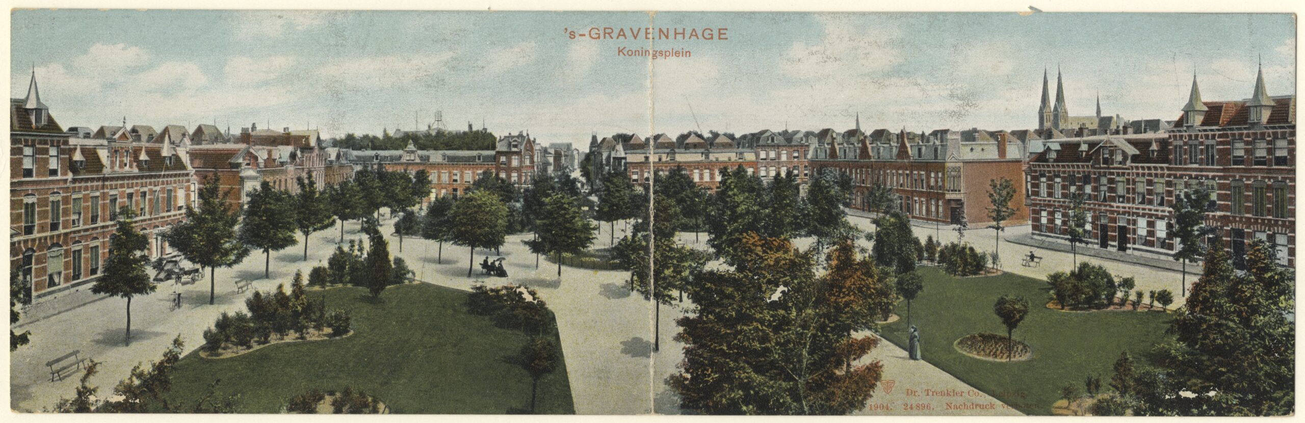
Archipelbuurt: beautification as a public utility
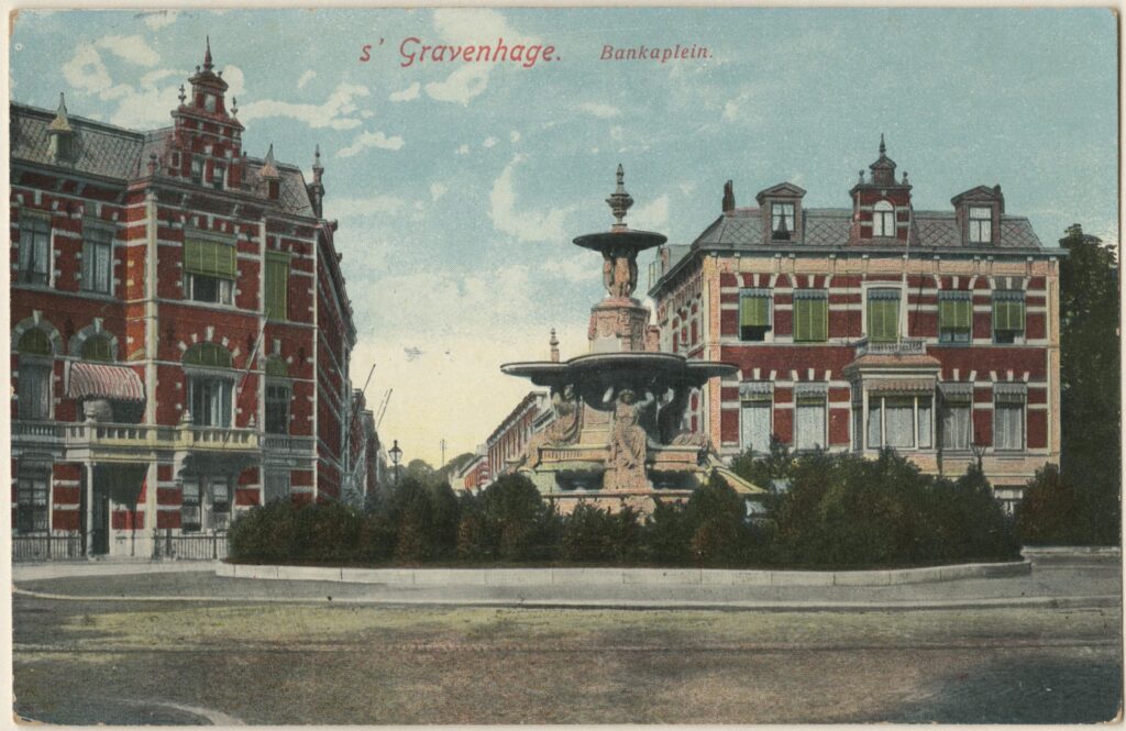
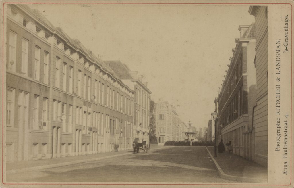
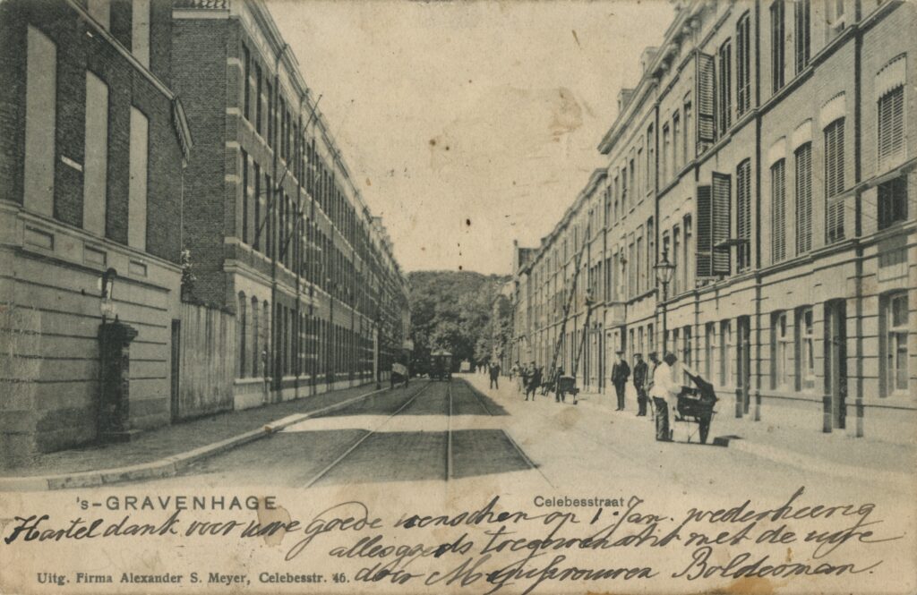
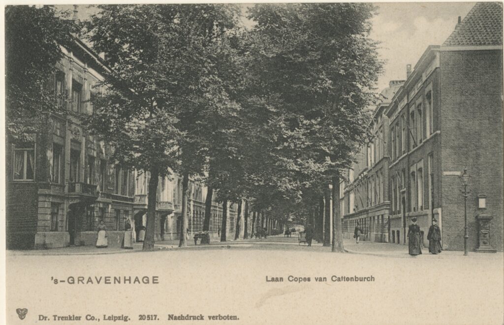
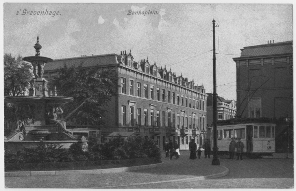
Building-land-companies that worked in the Archipelbuurt did see the usefulness of beautification for the neighborhood. The cooperation with the municipal architect was therefore a lot better. In addition, there were few existing buildings, so the problem of expropriation did not arise there. The street plans were laid out between 1869 and 1889 on the grounds of the Alexander kazerne (1841-1848) and a nearby dune meadow. Furthermore, the district was bordered by the Israelite (1690), Roman Catholic (1831) and General Cemetery (1830), and the Scheveningen canal, which had been dug between 1825 and 1834. The Javastraat (until 1861 the Schuddegeest) was an old country road. The most iconic building in this area was the Alexander kazerne with Alexanderplein, where the cavalry practiced. Behind this barracks were the sites where the new district was built.
The first street plan was by Maxwils: around the current Balistraat, Sumatrastraat and Laan Copes van Cattenburch. Where today the Balistraat and Laan Copes van Cattenburch are located, there was still a meadow in 1867. Maxwils bought several pieces of land here around 1867, bordered by the Schelpsloot, Javastraat, Kanaalweg (now Koninginnegracht) and the Laan Copes van Cattenburch, to develop a street plan. Maxwils worked on a main road over his building land from the Kanaalweg to the Scheveningseweg. Maxwils also did not start selling building plots at random and consulted with the city architect about the plans, in contrast to the building-land-companies in the Zeeheldenkwartier such as those of De Vletter and Klomp. The city’s board therefore strongly advised the council to be sympathetic to the assessment of Maxwils’ fine plan. The city architect and Maxwils had reached an agreement that was mutually beneficial was adopted at the city council meeting of January 21, 1868, when the Maxwils plan was being discussed. The council described it as fine and agreed to the planning. The intention was that construction would first take place along the Javastraat and the canal. Maxwils also wanted to release the other streets for construction and wanted the municipality to start building the streets earlier. It was important that Maxwils gave in to the municipal wish for a main road on the site of the building-land-company, the Laan Copes van Cattenburch. Finally, at the meeting of July 21, 1868, the council unanimously approved the plan and found a solution to the land exchange between the municipality and Maxwils. After that, development was halted in this part of the city for a number of years, perhaps as a result of the explosive growth of the Zeeheldenkwartier.
Behind the kazerne, De Lint cum suis and his Bouwgrond Maatschappij Duinweide bought land. It concerned almost the entire part west of what would later be called Bankastraat (probably the later Malakkastraat, Celebesstraat, Riouwstraat, Borneostraat and all the smaller streets and cross streets in between). The part east of Bankastraat north of Maxwils’ plan was also bought by De Lint (probably the later Delistraat, Riouwstraat, Atjehstraat and Batjanstraat). In the council decision of January 9, 1877, the street plan was approved. With the detailed plan, the city council submitted the conditions for this plan to the council on March 20. The streets had to follow the direction of the approved building plan; the main streets had to be 14 meters wide and the houses could not be higher than 15 meters; The other streets had to be 12 meters wide and the buildings could not be higher than 12 meters. Here, too, articles 44 and 45 of the police ordinance of 1876 also applied, but striking was the additional requirement that the committee made during the city council meeting of March 20, 1877 about the Plan De Lint Duinweide: no more courtyards could be built.
On November 4 and December 16, 1879, the city council discussed De Lint’s plan to build the extended Bankastraat and thus make a connection with the Kerkhoflaan. This required a land transfer from the municipality. In 1881, De Lint proposed to create a round-point with a monumental fountain at the intersection of Bankastraat and Riouwstraat on behalf of the building land company, with the condition that the municipality would take over this round-point and fountain. Two designs of a fountain by the architect Wesstra Jr. were presented to the council and the council was asked to make a choice. De Lint argued to the city council at a meeting of March 8, 1881, that: ‘The reasons which induce the Partnership to make this offer are: to make every effort on its part, which may be conducive to elevating the Duinweide building site more and more to one of the most graceful and pleasant districts of the municipality.’
Things were completely different with the lesser streets further down in the Archipel neighborhood near the Frederikskazerne. During the municipal council meeting of 23 December 1879, the master carpenter W.C. van Rijswijk applied to the municipality for permission to build a street between the Schelpkade and Frederikstraat. Presumably it was the Pr. Mariestraat near the Cantaloupenburg. The street had to be 11 meters wide and the buildings were allowed to be a maximum of 11 meters high, a deterioration of the police ordinance. Furthermore, the usual requirements applied with regard to pavement, sewers, damping of ditches and rounding of corners.
At a city council meeting on December 7, 1880, the layout of the last part of the Archipel neighborhood was discussed, the Surinamestraat and the Nassaukade (later the Nassauplein). The street plan was submitted by De Sonnaville, Post, Uijttenhooven, Braams and the architect Cornelis Jacobus van Roode jr., the partners in the Bouwgrond Maatschappij Suriname. According to the petitioners, the street plan was intended to contribute to the beautification of these streets. Part of the charity courtyard built by Saraber on the Schuddegeest from 1854-56 was demolished especially for this purpose. The new plan consisted of six streets, with the Surinamestraat in particular being given a representative character with a width of 26 meters and 8-meter green space with threes in the middle. A variety of architects from The Hague would build the houses, such as Van Roode (no.2-6, 8, 10-14, 22, 24, 30-32, 34-36, 38-40, 39-45), Besseling (9-17, 21, 23, 27, 29, 31, 33, 35-37), Wesstra (25, 28), Van Rijswijk and Posthuma (16, 20) and one of the highlights of the neo-Renaissance: the double mansion (42-44) with tower and stepped gable where government architect C.H. Peters lived and which he designed himself in 1880-81. For the rest, the usual rules of the police ordinance applied. The gentlemen also proposed to make the Javastraat 14 meters wide at their expense, so that it better connected to the Willemspark. The Surinamestraat, Nassaukade and Laan Copes van Cattenburch became an urban ensemble of size that buyers would certainly pay for.
Cooperation or not?
At the Zeeheldenkwartier there was the politically sensitive issue of expropriation of houses and building plots were already issued to increase the pressure on the municipality, even before the city architect and the building land company agreed. At the Archipelbuurt there was cooperation between building-land-companies and the municipality, with the common interest in creating beautiful urban spaces and through streets. The Zeeheldenkwartier was given a messy street plan where there was no room for through traffic and beautiful streets. For the Archipelbuurt, the Laan Copes van Cattenburch and the Javastraat became important through and representative streets.
The Zeeheldenkwartier and Archipelbuurt are both a patchwork of street plans of building-land-companies that were built over a period of about fifteen years. Three people were mainly active in the Archipelbuurt: Maxwils, De Lint and De Sonnaville. They made an effort to keep the quality of the neighborhood high, so that the value of the land they sold to building contractors also remained high. The slightly older and larger Zeeheldenkwartier had many more building-land-companies that were involved in the development. On Spanier’s map from 1864 (HGA kl.0463) there was no mention of street plans or buildings in the civilian neighborhoods and the working-class neighborhoods. Smulders’ map from 1870 (HGA gr.0325) showed the development around Anna Paulownaplein and the first construction activities in the Dichtersbuurt. On Stemler’s map from 1884 (HGA z.gr.0031) both the civilian neighborhoods and the working-class neighborhoods were almost fully built.
Cases of the working-class neighborhoods
The slums of the Schilderswijk, the Kortenbos and the Rivierenbuurt
Quite different were the urban ensembles in the workers’ quarters. These were dominated by monotonous urban blocks with low edge buildings with gable roofs perpendicular to the façade. In the houses along small streets were often workshops on the ground floor and houses above. In courtyards were slums with small back-to-back houses and small factories. For the most part, old patterns in the landscape were followed, such as ditches; These often also formed the plot boundaries. These neighborhoods arose in a chaotic way around factories and these factories were located at roads, railway, tramways and waterways such as the Spui and Loosduinse Vaart to be able to transport products to and from them. The structure of the neighborhoods was usually determined by the existing older buildings, drainage ditches, canals and roads.
The Schilderswijk was the largest neighborhood, there were already older buildings along the canals. There were also Rivierenbuurt, Kortenbos and the Spijkermakerskwartier. After the construction of Hollands Spoor station, the Stationsbuurt flourished. The city maps of Smulders & Cie from 1870 (HGA gr.0325) and Lobatto from 1891 (HGA 1891) show that the meadows of the Zusterpolder were already enclosed between the steam tram trace, the train trace and the canal before the great growth of the municipality. The Hoefkade was also present and cut through the meadows. The neighborhoods Rivierenbuurt and the Kortenbos were limited in size and had a wide variety of buildings: sometimes seventeenth-century, especially within the canals, but most from after 1870. In the official (architecture) historiography, working-class districts such as the Kortenbos, Spijkermakerskwartier and the Rivierenbuurt are virtually non-existent.
Thus, the individual buildings and neighborhoods were described in a larger context (Bakker Schut, 1939) (Dirkzwager, 1979) (Rosenberg, Vaillant, & Valentijn, 1988) (Creveld, 1989, 1999) (Koopmans, 2005). The socio-economic conditions of the inhabitants (Stokvis, 1987) (Schmal, 1995) (Oorschot, 2021). Or residents of a neighborhood such as in Het Kortenbos (Morren, 1900) (Langerak, 1984) (Wuite, 1990) (Langerak & Zomerveld, 1993).
The working-class neighborhoods did not have a systematic approach but were gradually parceled out by Public Limited Companies in the most economical way possible. That meant as few precious streets as possible; Hence the deep building blocks with the overcrowded courtyards. Business owners did not care about traffic connections or living conditions: the municipality supervised this with the summary police ordinance in hand. Bakker Schut (1939) showed what these working-class neighborhoods looked like for the different parts of the city on the basis of large wooden models. He compared the different densities. He also made photographs and maps of these neighborhoods. The creation of these districts coincided with the development of industrial activities in The Hague.
Around 1890 these working-class neighborhoods were fully built and that was also the turning point for the industrial activity of The Hague. The metal industry disappeared and the care industry subsequently occupied an important place (Stokvis, 1987). In the workers’ quarters there were no beautiful wide streets with ronds-points or parks that were built at municipal expense, such as the Scheveningse Bosjes. There was no discussion here about expropriating in order to create a beautiful cityscape. Here the free market prevailed and enlightened citizens made efforts to improve the lot of the affected population.
Charitable courts in response of the hygienists
The charity courtyards from 1840-1874 formed an iconic urban ensemble in which the Stedelijk Keur from 1841 played an important role. None of the courtyard houses were on the street and the ensembles formed introverted worlds. In 1840/41, the Diaconate houses and bakery were built along the Zuidwest Buitensingel specifically for the less fortunate, after a design by the architect Roodenburg. Due to the spacious layout and the front gardens between the houses, this complex remained a different oasis of greenery and tranquility in the Schilderswijk (Rosenberg, Vaillant, & Valentijn, 1988).
The Vereeniging tot Verbetering der Woningen van Arbeidende Klasse (Association for the Improvement of Housing of the Working-class, later transformed into the Koninklijke Haagse Woningvereniging van 1854, van Delprat built an ensemble of 42 blocks of 4 workers’ houses each with the architect Saraber on the Van Hogendorpstraat (1862/69) (Dirkzwager, 1979). A large part was demolished in 1931. These blocks were built on a large sand package, a kind of mound, so that the fumes from the peat soil could not harm the health of the residents. The houses are of honest and simple brickwork, while stucco has been applied on the inside, perhaps with the intention of reflecting the (day) light. The original faintly sloping roof is now gone; The houses were raised flat in 1941. After its completion, this project garnered much praise at the International Exhibition of Objects for the Craftsman’s Household and Business held in Amsterdam in 1868. This plan also attracted a lot of attention at the World’s Fair in Vienna in 1873 and the Centennial International Exhibition of 1876 in Philadelphia. A large wooden model was made for these exhibitions. The gardens around the residential blocks gave the whole a green and park-like character (Dirkzwager, 1979) (Rosenberg, Vaillant, & Valentijn, 1988). These charity courtyards are spacious with gardens for vegetables and herbs around the houses. Living and sleeping were separated, there was a private house and there was running water, while in the operating courtyards there was certainly no question of this.
In 1874, the Vereeniging tot Verbetering der Woningen van Arbeidende Klasse built Het Rode Dorp (The Red Village), several rows of low workers’ houses on narrow streets that were located between the Hoefkade and Parallelweg. In the meadows outside the city (around which the Regentessekwartier was later built) a neighborhood with workers’ houses was built as early as 1882. The client was the Coöperatieve Bouwvereniging Vooruit, founded in 1886, and followed by sister association Vooruit II. In 1888 this corporation built the 136 houses at the Gaslaan. As with the Red Village, sleeping and living were separated, there was a private and flowing water, but the urban spaces were poor, because there was a street of only ten meters wide. Scattered throughout The Hague were several other charitable courtyards.
In the year of the founding of the Vereeniging tot Verbetering der Woningen van Arbeidende Klasse, in 1854, the architect Saraber submitted the plans for homes for the less wealthy on the Laan van Schuddebeurs (later called Javastraat). Stunned by the intended proximity of workers to the exemplary Willemspark, the municipality rejected the plans. However, the board of the association was not bothered by the refusal of the municipal administration, withdrew its request for a permit and immediately started building the Hofjes van Schuddegeest. They simply invoked the Stedelijk Keur from 1841.
In 1868-69 the Vereeniging (association) built the Mallemolenhofje, designed by the carpenters J. Jager and S. van der Kamp. Then, in 1881, the association built the workers’ houses at Paramaribostraat 23-141, next to the two other workers’ courtyards. These were by the architect H. Wesstra jr. Between the current Javastraat and Laan Copes van Cattenburch, next to the monumental Surinamestraat, the largest cluster of courtyard houses in The Hague was created in the vicinity of the Willemspark according Dirkzwager (1979).
The Lammers Stichting (foundation) also built various charitable courtyards, such as in 1875 at Schelpstraat 5-53 and Badhuistraat 170-188 (Koopmans 2005), currently owned by the Koninklijke Haagse Woningvereniging van 1854 in which the Lammers Stichting and the Vereeniging tot Verbetering der Woningen van Arbeidende Klasse have been merged. There was also the initiative of pastor Rev. Th.C.R. Huydecoper, who in 1886 founded the Huydecoper’s Stichting, a branch of the Nederlandsche Vereeniging tot Afschaffing van Sterken Dranken. Spread throughout The Hague and Scheveningen, this foundation owned houses that were rented at a low price to workers who could prove that they did not use liquor (Bakker Schut, 1939). The Red Village and the Gaslaan were charity courtyards, but the atmosphere and the image approached that of poor mans’ courtyards. Here there are no beautiful urban spaces or plants, but long boring streets of ten meters wide.
The chaotic street layout of the workers' quarters 1877-80
Disorganized, step-by-step and at a rapid pace, the workers’ quarters were filled up. One street was fixed to the other. Here the conditions as set out in the police ordinance of 1876 and thereafter applied:
The direction of the street, according to the drawing of the building land company, with modifications from the municipality, had to be submitted to the council for approval by the municipal executive (mayor and aldermen). The council acts then included the street widths as agreed with the building land company. The minimum width of the street was equal to the maximum height of the façade. The width of the residential street was at least 12 meters, so the height of the façade there was a maximum of 12 meters. The width of a through street was at least 14 or 15 meters, the height of the façade up to 14 or 15 meters. Pavement consisted of bricks across the full width, without sidewalks. Streets were raised with pure sand, according to the level indicated by the municipal executive. The building height was calculated from that level. Corner buildings of each street were rounded with a radius of 3 meters. Furnishings of indoor and outdoor sewers were inspected by the construction police before they were approved by the municipal executive for connection to the main sewer. The street was only taken over by the municipality when more than half was built up. This last rule aroused resentment among many residents, who often had to wait a long time for this. However, there was a lot of deviation from these meagre rules and that did not always benefit the districts.
The following examples show how messy and unstructured the layout of the neighborhoods was. Pasture by pasture was built up. In January 1877, H.D. Hoos and J. Lamet asked the council for approval for the extension of the Boekhorststraat into the Koningstraat between the Hoefkade and the Parallelweg. The width became 15 meters; The remaining streets were 12 meters wide. This was discussed at the meeting of the council on May 29, 1877. The Kortenbos district was built with one street plan during this period. On 6 February 1877, the city council considered the proposal of the Hague architects H.P. Vogel and N.A. Allot for a permit for several streets, presumably Sirtemastraat, Twenthstraat (which was then between Sirtemastraat and Kortenbosch) and Noordstraat.
At the meeting of 17 April 1877, A.H. Sterkman requested approval for two streets west of Paulus Potterstraat, presumably Van Dijckstraat and Rembrandtstraat. For the meeting of 15 January 1878, A. van Stolk and sons from Rotterdam submitted a plan for the site outside the Zuid Oost Buitensingel in the Rivierenbuurt, a neighborhood with streets of 12 meters wide, probably the Amstelstraat, Waalstraat and IJsselstraat. For the Schilderswijk Noord, along the Zuid West Buitensingel, J.A. van der Leeuw applied for permission for the construction of various streets in 5 February 1878. The city council advised the council to agree to streets that were significantly narrower than the minimum specified in the police ordinance. The streets were 10 meters wide and 9 meters from the shoring of the canal. The council agreed.
On March 8, 1879, notary A.G. Bodan offered in a public sale the street plan from Ravensteijnstraat, Van Dijckstraat and Paulus Potterstraten to Hoefkade, property of the heirs of J. Sillevis. The council was asked for permission to approve the transaction. The municipal executive suggested the council agree according to the usual rules. At the Hoefkade, a width of 12 meters had to remain, presumably because the other side had already been built on. The city council also demanded that an additional cross street with a width of 12 meters be constructed. Presumably it was the Van Ostadestraat. It was also striking: ‘The Mayor and Aldermen also advise the Council to promise the addressee the takeover, lighting and sewerage of the streets as well as the construction of water supply.’ (City Council meeting April 8, 1879). Facilities such as lighting and drinking water were previously not required by the municipality. Eventually J. van Lith Jr. would take over the street plan (City Council meeting September 27, 1881).
In April 1879, S. van der Kamp and J. Roosmalen submitted the street plan from the Zuid-Buitensingel to the Hobbemastraat to the council for approval. Presumably it was the Rembrandtstraat and Rubensstraat (City Council meeting 22 April 1879). In January 1880, the bricklayer W. Hamel also applied for a permit for the construction of two streets behind the Zuid West Buitensingel. It concerned the extension of the Wateringsestraat, a street parallel to it and a cross street. There, too, the council agreed to a 10-metre-wide street, a deterioration in the police ordinance (City Council meeting 6 January 1880).
In October 1880, F.J.O. Beckering proposed the extension of the Falckstraat near the Oranjeplein and to the Parallelweg to the council for approval on October 5, 1880. etc. etc. In short, the street layout in the working-class neighborhoods took place chaotically and step by step. They built up meadow by meadow. The streets were long and narrow: 12 or even 10 meters. The courtyards full of slums with back-to-back houses, virtually without facilities such as toilets and drinking water, were not assessed by the municipality.
This list shows also the disorganization and deviations from the building rules of the General Police Ordinance, which did not benefit the neighborhood. The majority of the city council agreed without hesitation.